Slovenia
Slovenia
Guide to Slovenia
Slovenia is small, but it opens up beautifully. In the span of an hour, you can go from a city to the woods, from a valley to a hilltop, from a train to a hiking trail. This page is a short, practical guide, shaped by my own experience exploring Slovenia.
Region
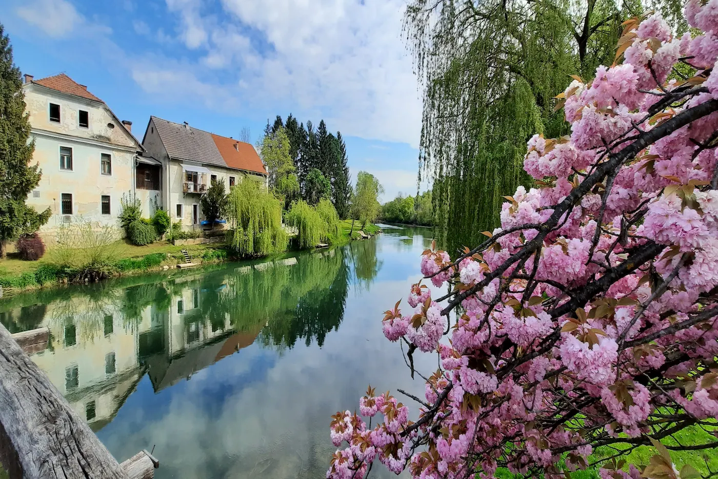
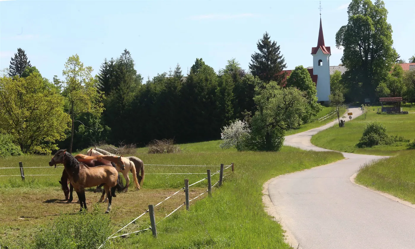
Mura – a mini regional guide
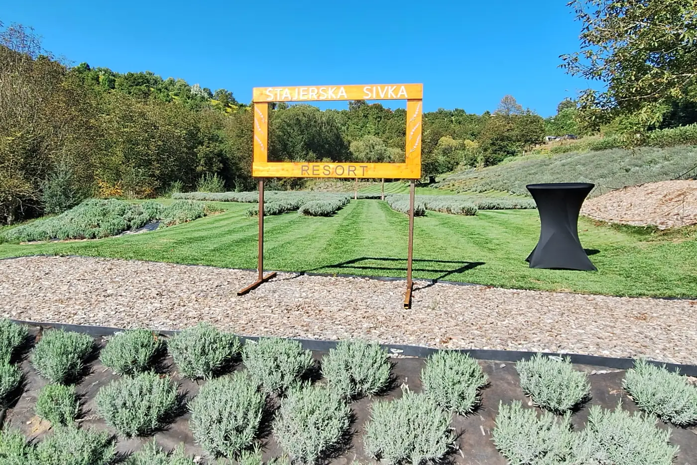
Prekmurje and Prlekija are a perfect pick for a weekend getaway in Slovenia.
Mura is not a place you simply tick off a list. It is the kind of region that quietly stays with you.
The region lies in northeastern Slovenia and covers roughly 1,337 km² of Slovenia’s territory, with around 114,000 residents, which is about 5.4% of the country’s total population.
It is more sparsely populated, with a slightly older population than much of the rest of Slovenia, which gives it an even calmer, almost rural pace of life. It is still considered one of the country’s less developed regions, so living costs, especially real estate and services, are generally lower than in some other parts of Slovenia.
Why Mura
-
Flatland rhythm:
Mura is ideal for a weekend escape. Distances are short and places are easy to reach. Bike ride or walk in the morning, a good meal at noon, and then a lake or a stop by the Mura River in the afternoon. -
Goričko for views and slow curves:
the rolling hills, vineyards, and roads feel made for a road trip. Once you reach a viewpoint, the region starts explaining itself. -
A creative tempo:
if you ever need a region for writing, photography, or simply collecting experiences on the road, Mura region delivers. Inspiration comes easily here. And if you want to go deeper into that way of seeing, I share that kind of experience in my notes, shaped over the years on similar trips. -
Prlekija:
a little more cinematic, because the light here seems to frame its own scenes. A little more wine-soaked, because conversations rarely stop at one story. Sometimes a little more playful too, because people from Prlekija do not overcomplicate things — they would rather say it plainly. -
Grossmann Festival:
a cult summer festival of fantastic film and wine in Ljutomer (running since 2005).
Do not miss
-
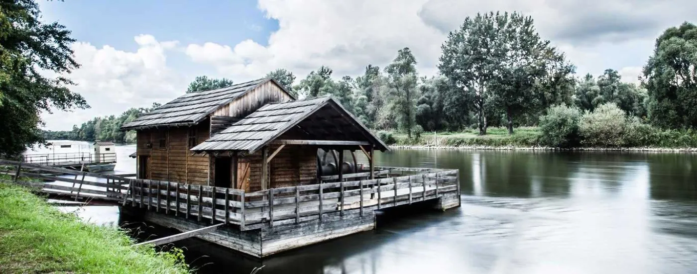
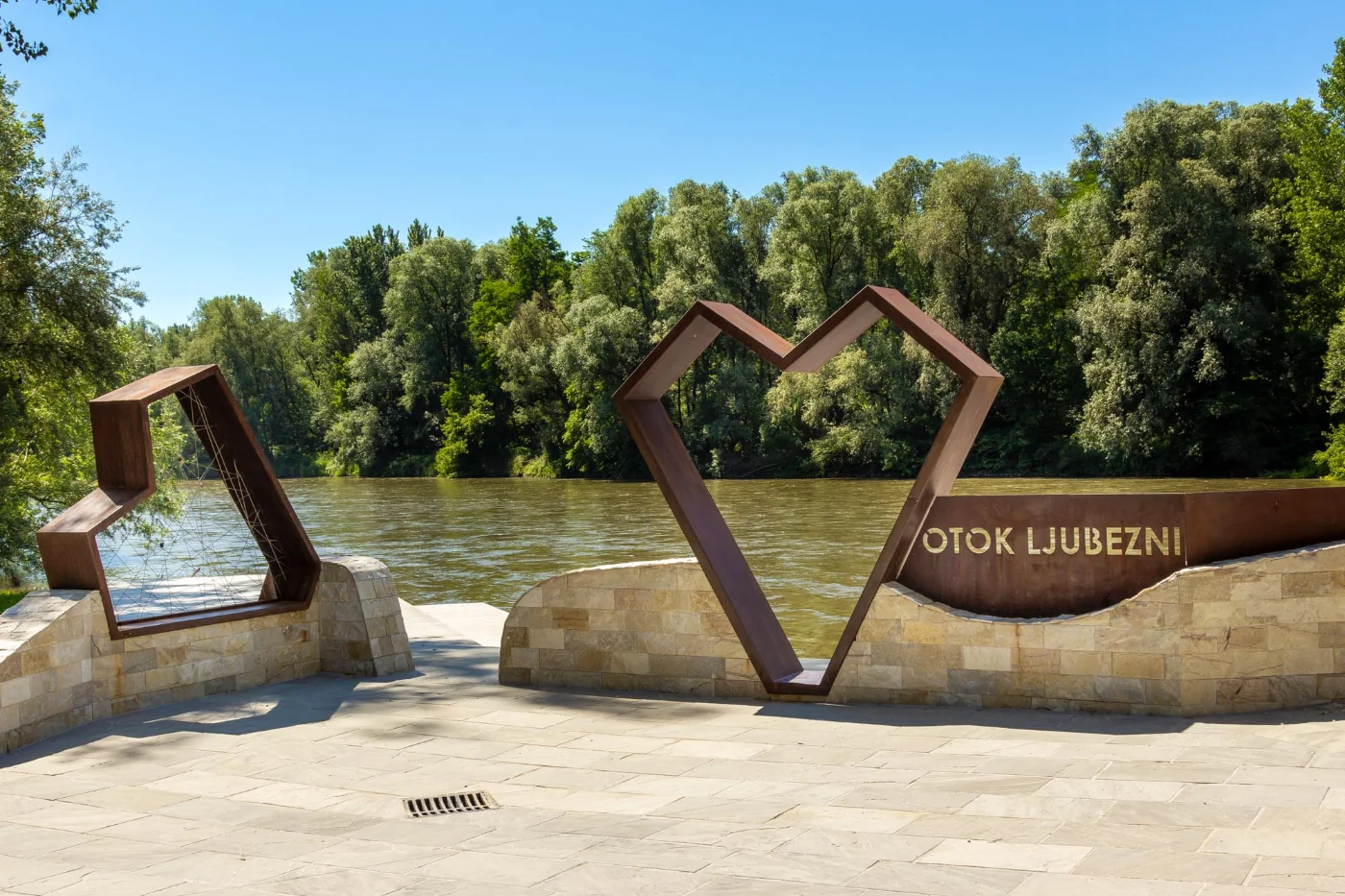
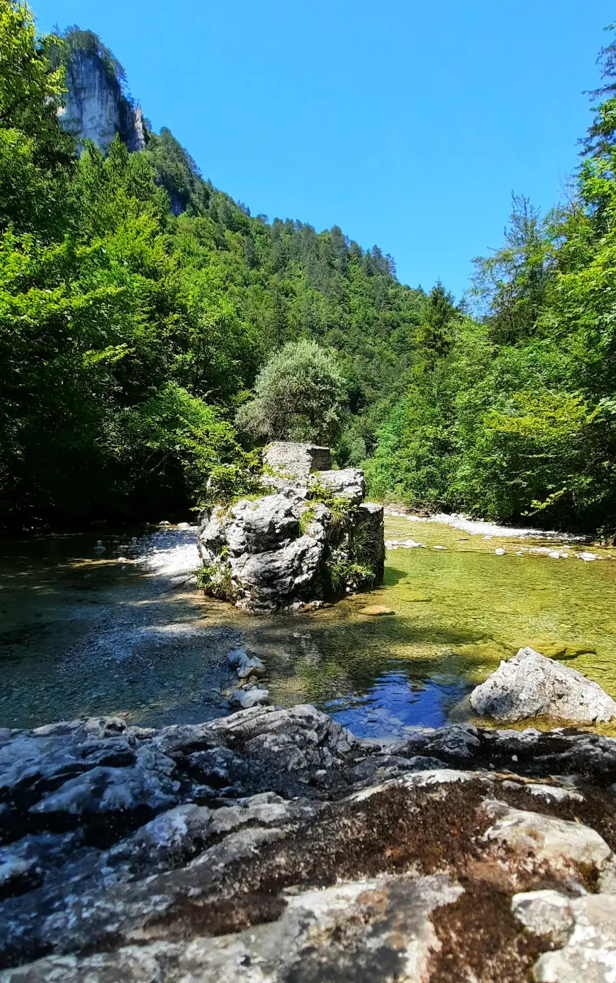
Island of Love (Ižakovci) – Mura River:
a lovely, almost analog glimpse into river life. Add a short walk along the bank and you have a day that feels fully used in the best way. -
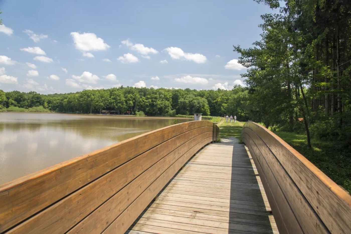
Bukovnica Lake:
an approximately 8-hectare reservoir in the forests of Prekmurje, surrounded by beech, chestnut, and hornbeam woods. You can enjoy a circular educational trail of about 1.7 km, fishing, a picnic, or camping. By the lake there is also a fairy-tale forest corner for kids and an adventure park with climbing routes and a zip line for all generations. -
Ocean Orchids (Dobrovnik):
while smaller than Arboretum Volčji Potok, it offers a similar floral abundance.
approx.: €7
-
Goričko and Grad Castle:
the castle is a great starting point for exploring Goričko Landscape Park, the largest landscape park in Slovenia.
approx.: €5
-
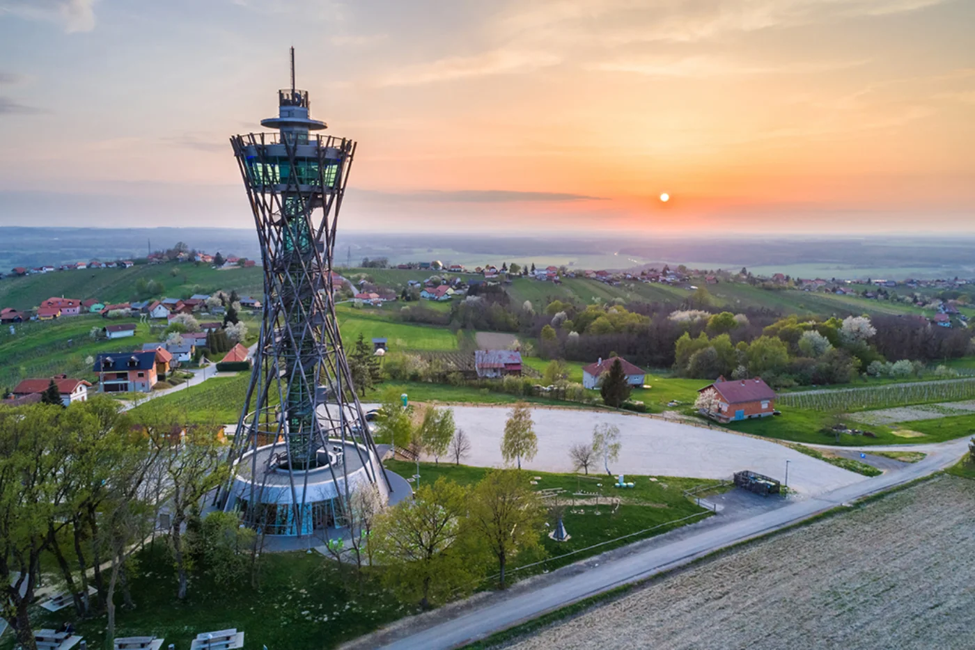
Vinarium (Lendava Hills):
one of those places where you really feel the openness of Prekmurje. The tower is not about adrenaline, but about perspective: a 360° view across vineyards, plains, and the borders of four countries puts things into place fast.
approx.: €7 -
Soboško Lake (Murska Sobota):
a well-kept walking and recreation route. A nice contrast if you are staying in the region for a few days. -
Filovci Pottery Village:
an open-air museum and a close-up look at local craftsmanship. The traditional Pannonian houses known as “cimprače” and the story of Filovci pottery are especially interesting. -
Expano (Murska Sobota):
if you arrive in Prekmurje without a clear plan, this is the best first stop. Expano is not a classic museum, but an interactive introduction to the region.
approx.: €14
Note on prices: listed prices are for general reference only (2026).
Mura in one scene
The Mura
The Mura river has its own rhythm and does not bring dramatic adventures with it. For something more active, head toward Goričko, where the landscape begins to rise just enough to give you a view and the feeling that you have earned a good meal.
For foodies
The landscape may be flat, but the flavors are anything but. Here are a few tastes that absolutely belong in a You have to try this category.
-
Prekmurska gibanica:
a protected traditional dessert with layers of poppy seeds, curd cheese, walnuts, and apples. I first tried it in my hometown and it won me over immediately. -
Bograč:
a rich stew often described as a Prekmurje-Lendava classic, with its own competition in Lendava. -
Pumpkin seed oil:
a darker, aromatic “liquid gold” from the Styria-Prekmurje area. Most at home on salad, but surprisingly good with ice cream too. -
Dödöli:
a simple local potato dish served with onions and cracklings. -
Prlekija wines (Šipon/Furmint):
if you add Prlekija to the trip, add a glass of šipon as well — a dry white wine with character that fits the rhythm of the landscape beautifully. -
Homemade cured meats:
tünka, ham, and lard spreads are not for everyone, but they are undeniably part of the region’s identity.
Pomurje works best when you let things unfold naturally. You can start your own path with writing tips.
AGRA Fair
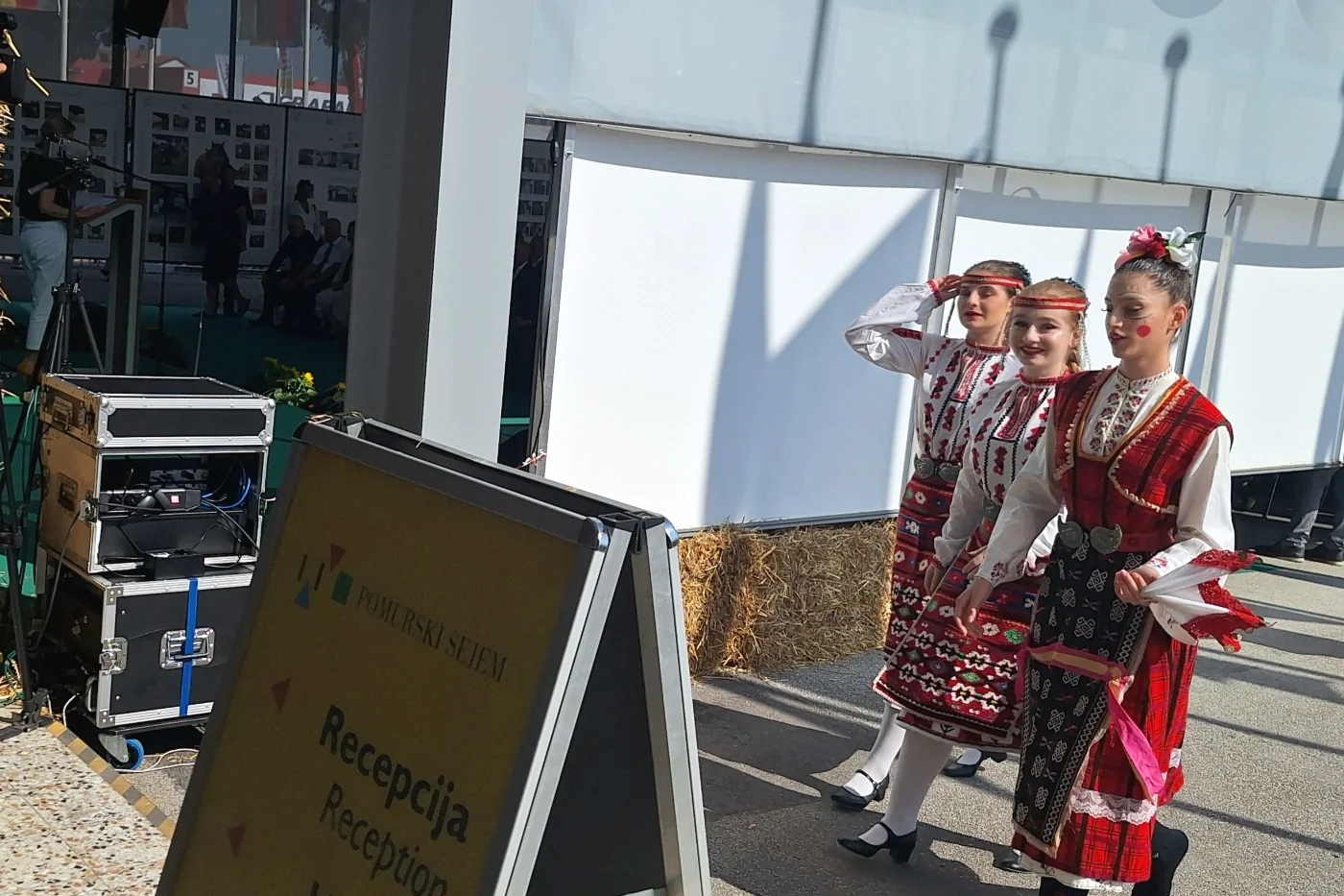
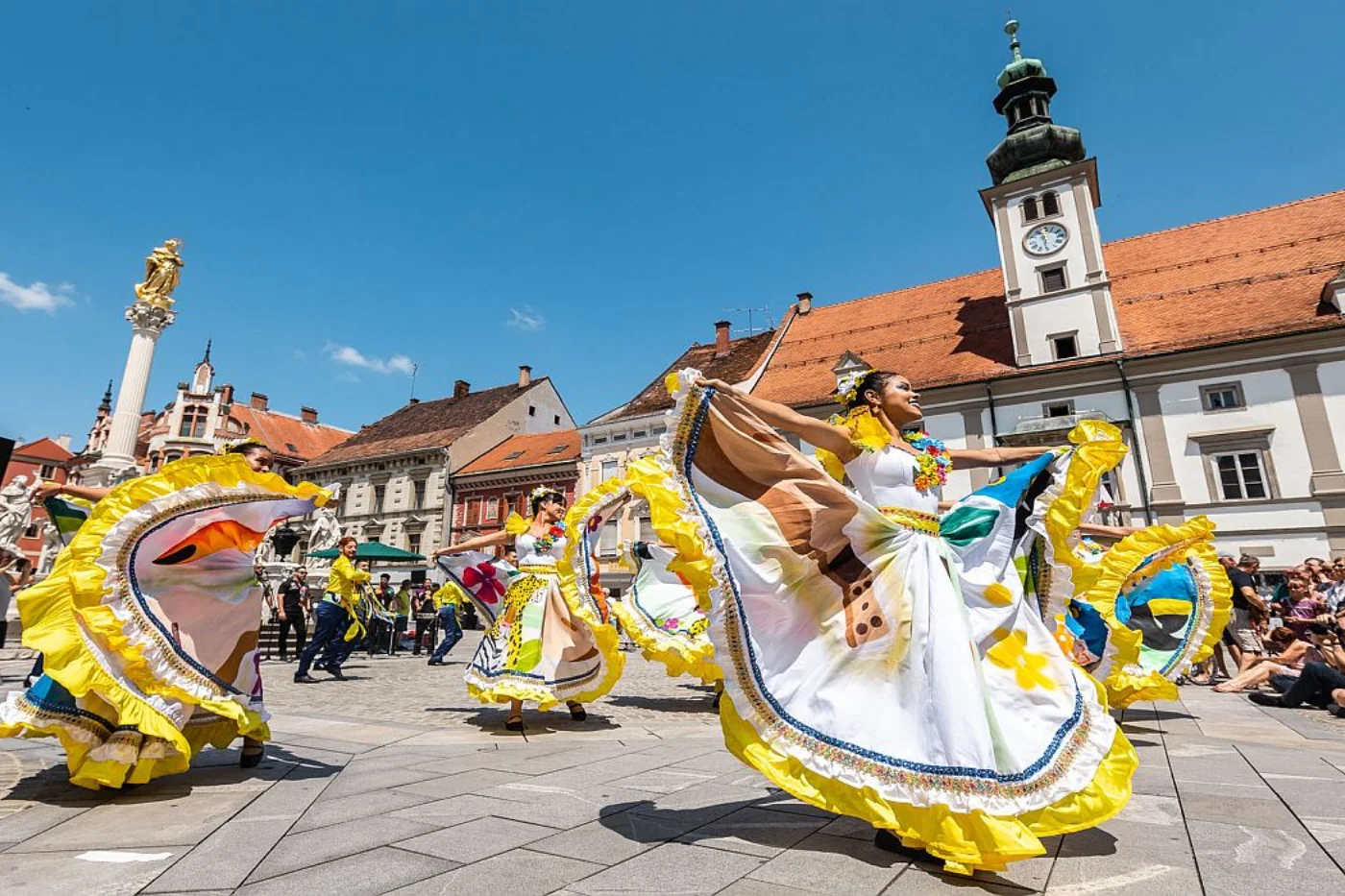
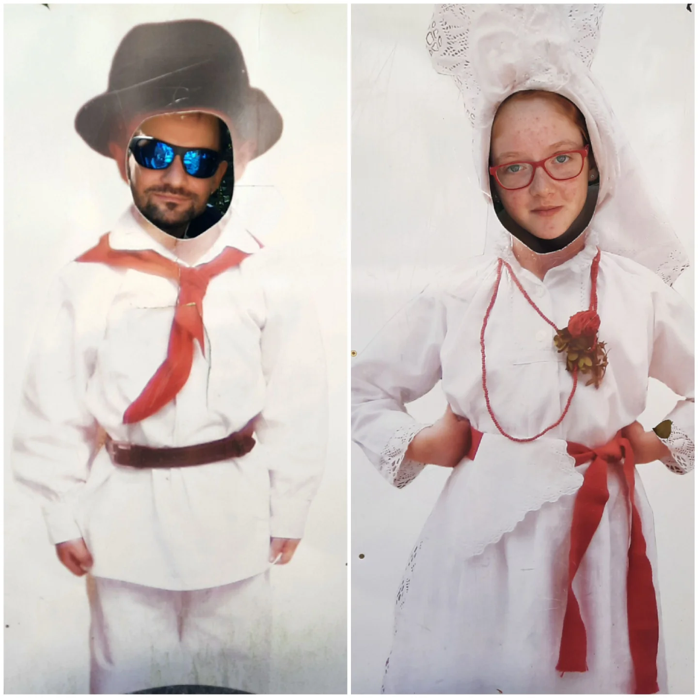
Every summer, Gornja Radgona becomes one of the main meeting points for agriculture, food, and rural culture in this part of Europe. The international AGRA agricultural and food fair is the largest event of its kind in Slovenia, with more than 1,700 exhibitors from over 30 countries and around 100,000 visitors.
At the fair, technology, local food, animals, machines, and — what I always find most interesting — people from different countries and cultures all come together. The photo of girls in traditional dress shows how this border region, near Hungary and Austria, has long been shaped by overlapping influences. I was here on business, and I can only confirm that Pomurje is truly a place of meeting and connection.
Region
Drava – a mini regional guide
Pohorje, vineyard-covered hills, and Maribor as a natural base for an active or relaxed day.
Drava by the numbers
- Location
- northeastern Slovenia
- Area
- 2,170 km²
- Population
- 330,000
- Share of Slovenia’s territory
- 10.7 %
Drava region includes the urban center of Maribor, the forested areas of Pohorje, and the wine landscapes of Slovenske gorice and Haloze. Its character is therefore mixed. It works at the same time as a city region with a university pulse and as a woodland region of plateaus, marshes, scenic roads, vineyard cottages, and farm stays.
Best experiences in Drava
-
Pohorje:
it looks its best in winter, although the last time we were there, on 02/20/2002, we were met by green meadows full of spring flowers. Besides cyclists, you will find excellent loop trails, forest roads, high plateaus, and views over Maribor. A classic Pohorje image is Lovrenška Lakes — wooden walkways between marshy pools. -
Drava River:
Maribor has a river that is not just scenery — it is part of daily life. Lent and the promenade make for the kind of walk you take without a fixed plan. -
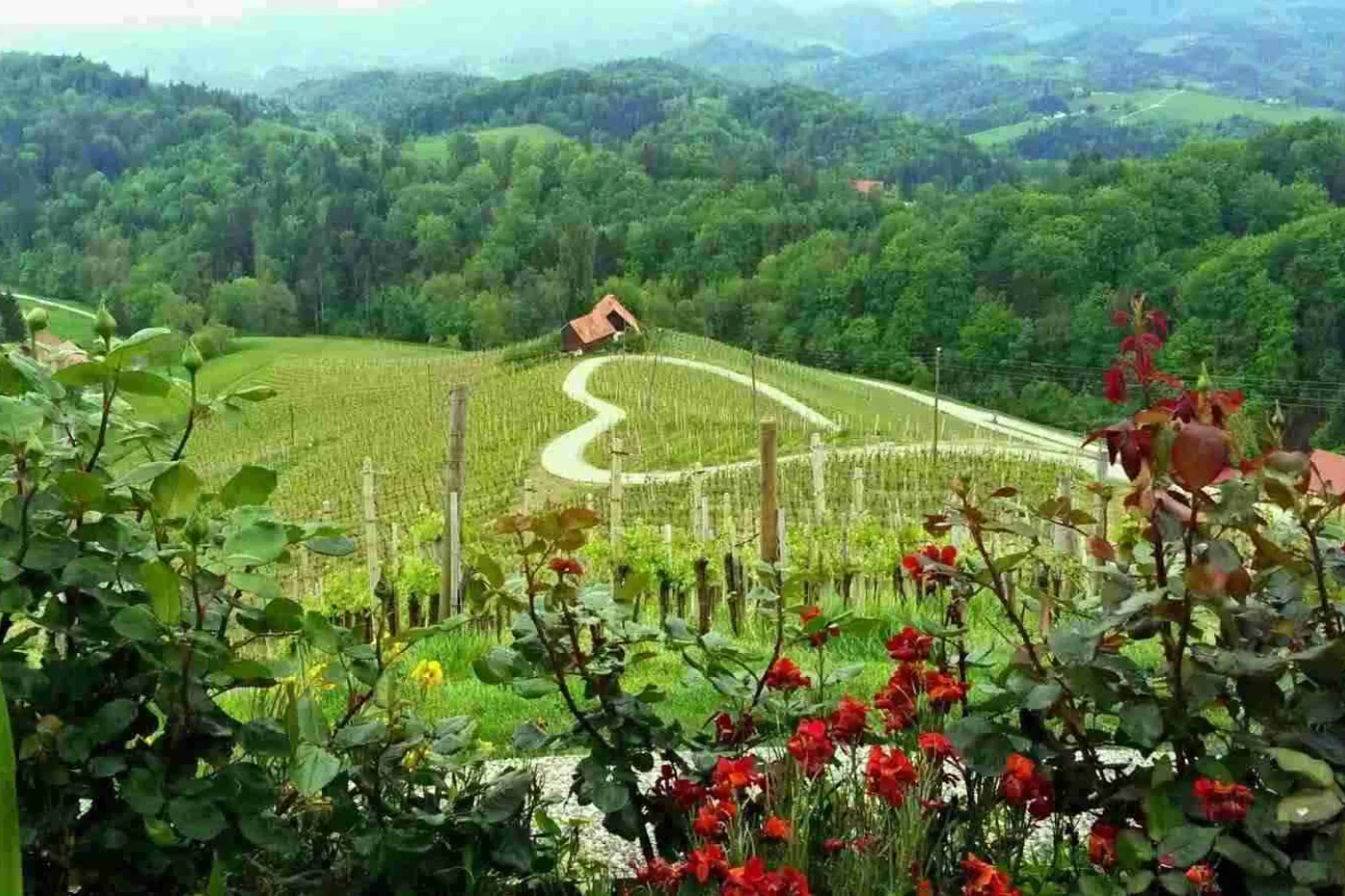
Wine hills (Slovenske gorice and Haloze):
the kind of views that feel like a reward for sticking with the climb. These are roads made for taking your time, where the route matters more than the destination. Just keep an eye on where exactly they lead and how narrow they get.
Do not overlook
-
The Old Vine (Maribor – Lent):
a city icon and a quiet reminder of local resilience. It is over four centuries old and listed in the Guinness Book of Records as the oldest noble grapevine in the world still bearing fruit. -
Festival Lent (Maribor):
in summer, Maribor gets noticeably louder. Stages appear practically everywhere, people spend more time outside than in, and evenings have that familiar feeling of “one more song and then I’ll go” — and then you stay. -
Ptuj:
it holds a special place for me because it is my father’s hometown. For several years, the area around Ptuj was the destination of regular weekend trips. Today it makes an ideal day trip, where the main plan is little more than a good coffee and a walk through the old town. -
Kurentovanje (Ptuj):
the sound of bells, the energy of the crowd, and a uniquely strange blend of tradition and carnival that is impossible to explain unless you experience it live at least once. -
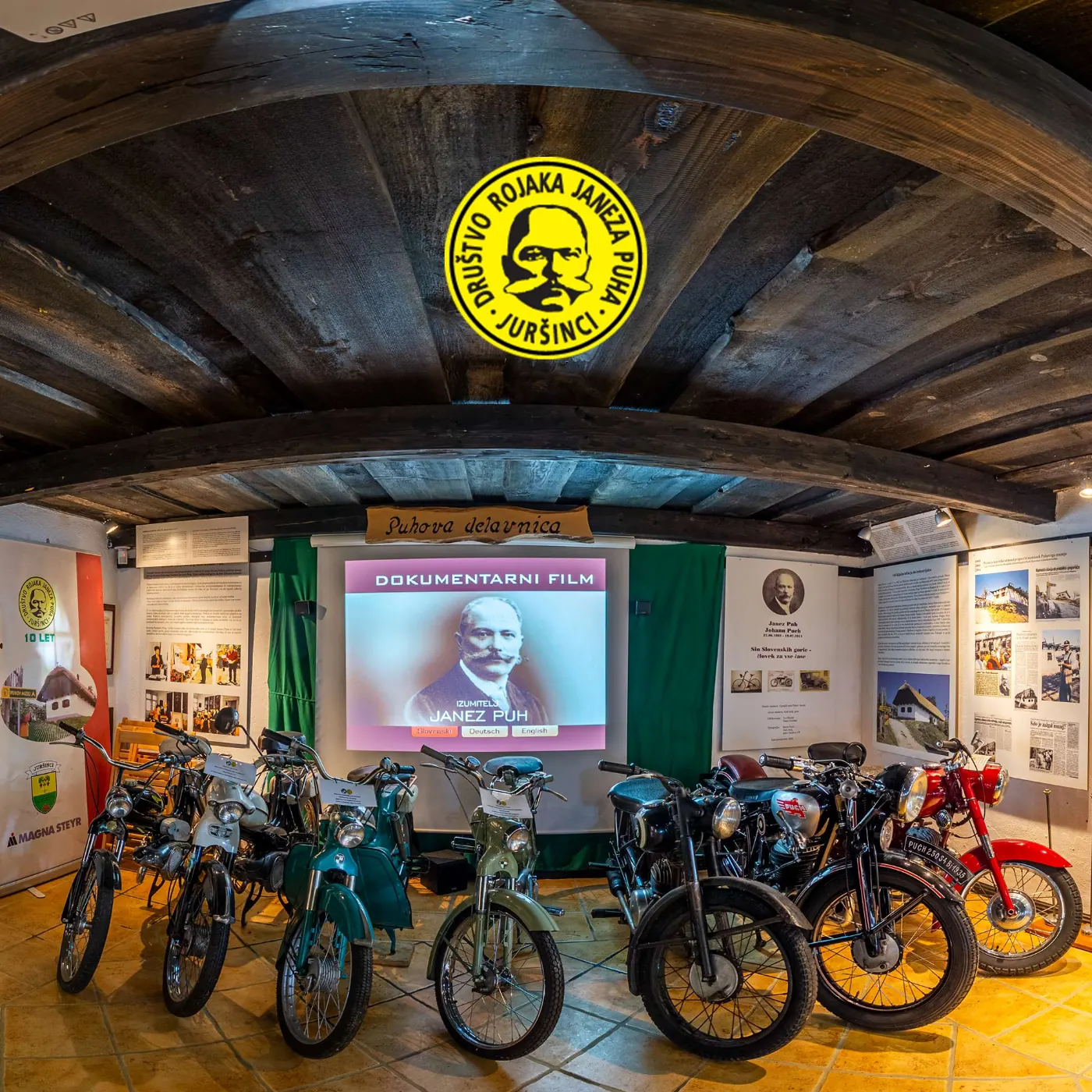
Puh Museum (Sakušak near Juršinci):
a small stop with a lot of story. Great for all technology enthusiasts and lovers of invention, vintage vehicles, and nostalgia from another era. It reminds you that even a seemingly ordinary village can leave a global mark.
What to do
Active
- Trail running or MTB on Pohorje.
- A hike to Lovrenška Lakes.
- Cycling along the Drava River.
If you are looking for a cycling idea:
the Drava cycling route is an international route along the Drava River, and in Slovenia it also passes by Maribor and Ptuj.
Slow travel
A dessert that belongs here:
pohorska omelette — a local classic from the Maribor–Pohorje area. It is a fairly serious dessert with blueberries, powdered sugar, and that feeling that you definitely took one bite too many.
- Tastings in Slovenske gorice and Haloze.
- A city day in Maribor or Ptuj.
- Wine-country views at sunset, just a short drive from Maribor.
Mini itineraries
-
1 day – Maribor and the Drava:
morning in Lent and by the Old Vine → lunch in the city → afternoon walk or bike ride along the Drava → evening festival/concert. -
1 day – Pohorje:
morning forest hike (Lovrenška Lakes) → late lunch in the valley → vineyard views. -
2 days – regional classics:
day 1 Maribor and Pohorje → day 2 Ptuj (old town and castle) and the wine road through Slovenske gorice/Haloze.
Guided options
If you would rather let someone else handle the planning — or just want a few ready-made experiences — take a look at guided tours and activities in Maribor.
Region
Carinthia – a mini regional guide
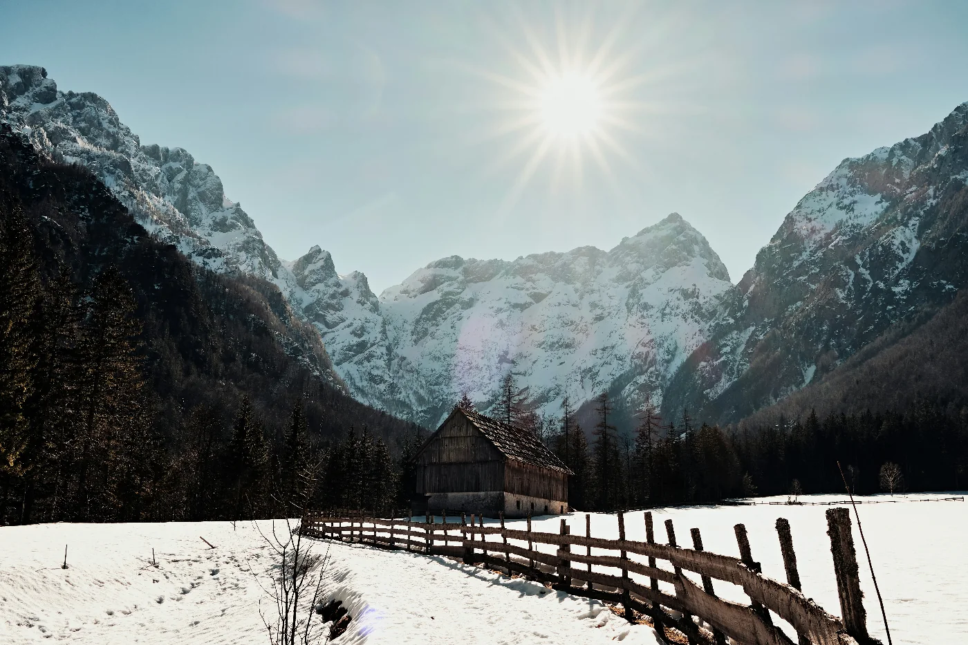
Forests, plateaus, and a rugged rhythm in the north of the country.
Carinthia is one of Slovenia’s most heavily forested regions. The roads here feel wilder and less busy, and the views more raw and postcard-worthy.
Carinthia by the numbers
- Location
- northern Slovenia
- Area
- ~ 1,041 km²
- Population
- ~ 71,000
- Share of Slovenia’s territory
- ~ 5.1 %
The region lies along the Austrian border and is known for forests, plateaus, and industrial heritage. Because it is more sparsely populated, it is one of Slovenia’s quieter regions, which makes it ideal for hiking, cycling, and escaping city crowds.
Carinthia at a glance
- Lots of forest trails, very little crowding.
- Countless ridgelines and plateaus.
- Excellent for trail running and day tours.
Do not miss
- Peca and the underground world beneath it.
- Uršlja gora.
- The Drava Valley with its cycling routes.
The underground world of Peca / Mežica
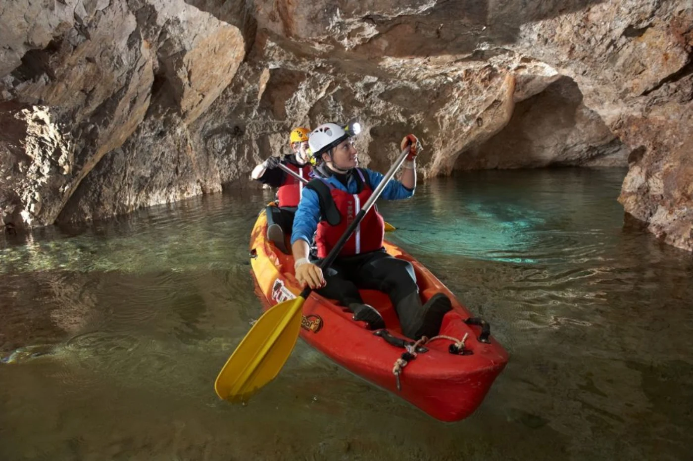
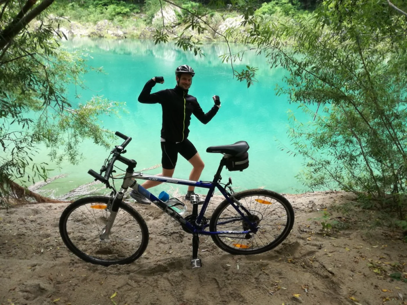
If Koroška above ground feels like a region of forests and ridges, below ground it reveals an entirely different layer. The Underground of Peca (Mežica) is a former lead and zinc mine transformed into an experience.
You can experience it by miners’ train, by kayak, or by bicycle. All three options have an almost cinematic feel and the sense that you are cut off from the world for a few hours.
-
Kayak tour:
the mine stays at a steady 10 °C year-round, so an extra layer is almost essential. Advance booking is mandatory. -
Train tour:
the “classic” mining experience, where the train takes you into the tunnel system and a guide then leads you on foot through the story of how work underground once looked. -
Underground cycling:
only possible with a mountain bike (e-bikes are not allowed), and mandatory safety equipment is required. -
If you want a more overtly “tourist” frame:
paddling along an underground river to mysterious lakes resting 700 meters below the earth’s surface has a special kind of magic. Unlike Škocjan or Postojna-style cave visits, this feels less like sightseeing and more like joining an expedition.

Peca (Kordeževa glava, 2,125 m)
The classic, well-marked approach to Peca leads to Dom na Peci from below Podpeca (Mitnek), from where you can continue toward the summit.
- Starting point: Mitnek (Podpeca).
- Goal (basic hike): Dom na Peci (1,665 m).
- Hiking time: 2 hr 15 min.
- Elevation gain: 775 m.
- Continue on: to Kordeževa glava add about 1 hr 20 min by the more demanding trail, or up to 2 hr by the very demanding route.

Uršlja gora (Plešivec, 1,699 m)
A popular, easy, and scenic hike. Just below the summit stands St. Ursula’s Church, considered the highest-elevation church in Slovenia.
- Starting point: Koča na Naravskih ledinah (1,072 m).
- Goal: Uršlja gora (1,699 m).
- Hiking time: 1 hr 30 min.
- Elevation gain: 627 m.
- At the top: Koča na Uršlji gori mountain hut and St. Ursula’s Church.
Mini itineraries
- 1 day: Uršlja gora and lunch in the valley.
- 2 days: Peca and an underground adventure in the Mežica mine.
What to do
- Trail running.
- Hiking across the plateaus.
- The Mežica mine.
Food tip: after a concert, a few friends and I went out for pizza and it was genuinely excellent — Pizzeria Gajbica.

A moment from the region
Beyond nature, Koroška is also known for its strong sense of community. More than anything else, it is often the people and their connections to one another that define the experience of the region.
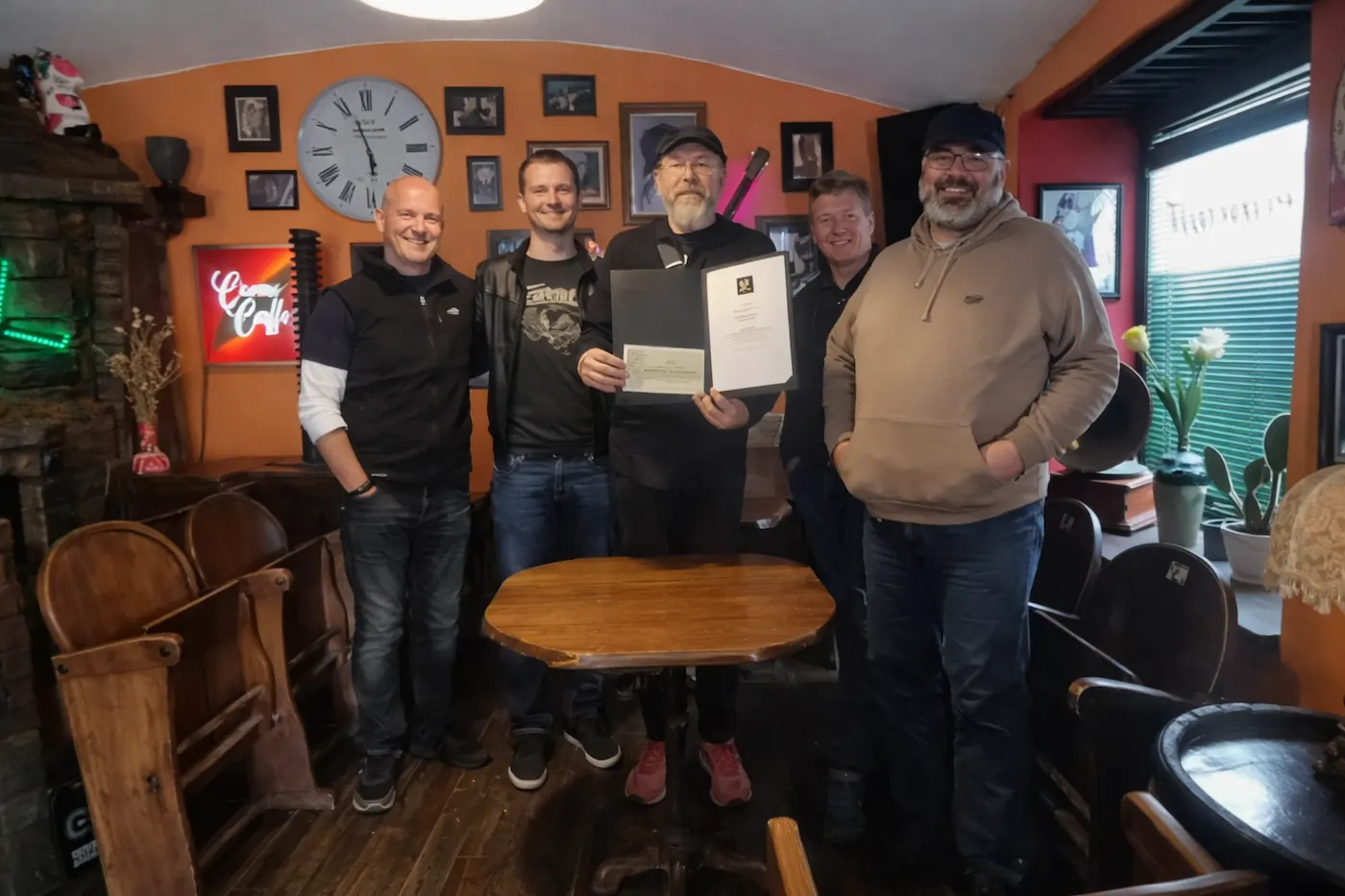
After the floods of 2023, our music group played several charity concerts, including one in Prevalje, where the damage was among the most visible. The purpose of the concerts was to raise funds for firefighters and mountain rescuers, who were among the first to respond — even though many of them had lost nearly everything at home themselves.
That experience is just one of many stories showing how Carinthia comes together when it matters most — directly, wholeheartedly, and sincerely.
Region
Savinja – a mini regional guide
Savinjska is one of the most diverse regions: Alpine valleys, the Kamnik-Savinja Alps, vineyards, spa towns, and hills all within roughly an hour.
Savinja by the numbers
- Location
- eastern / northeastern Slovenia
- Area
- 2,301 km²
- Population
- 260,000
- Share of Slovenia’s territory
- 11.4 %
Why this region stands out
-
Alpine panorama:
Logar Valley and the Solčava area are photogenic enough that you do not need to chase the perfect frame — just drive through the gorge and enjoy the scenery and nature. The vehicle entrance fee (for example, around €10 for a car and €7 for a motorcycle) includes parking and access to marked stops throughout the valley. -
Cycling routes:
around Laško you will find a varied network of cycling routes and tours for road, trekking, and mountain bikes, from pleasant flat stretches along the Savinja River to panoramic local climbs and marked loops around nearby towns and villages. -
A city with a story:
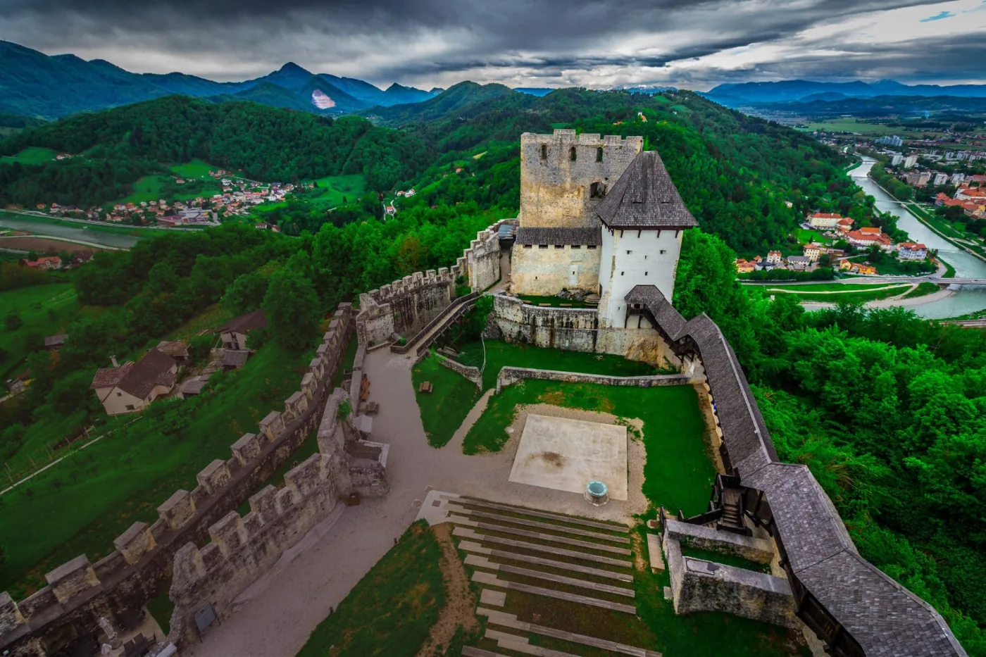
Celje was once a princely town — home to the Counts of Celje, one of the most powerful noble families in the territory of present-day Slovenia. Once you step onto Celje Old Castle (the largest medieval castle in Slovenia) and look out over the Savinja Valley, it becomes obvious why the city mattered strategically. You can continue the walk to the Celje Regional Museum, home to the Celje Ceiling, one of the finest examples of Renaissance painting in Slovenia, or stroll through town past the remains of Roman Celeia.

Mini guide to the stops
Robanov kot is the kind of Alpine valley that makes you feel as if you arrived too late, simply because you should have stayed longer. The valley was shaped by glaciers and is broad enough for a walk or a ride. A great choice when you want peace but still want the feel of a mountain amphitheater.
Palenk Waterfall is perfect for a short stop. It is most impressive after rain and in the shoulder seasons (spring/fall), when the flow is stronger. If you are already in Logar Valley, this is one of those natural sights worth not skipping.
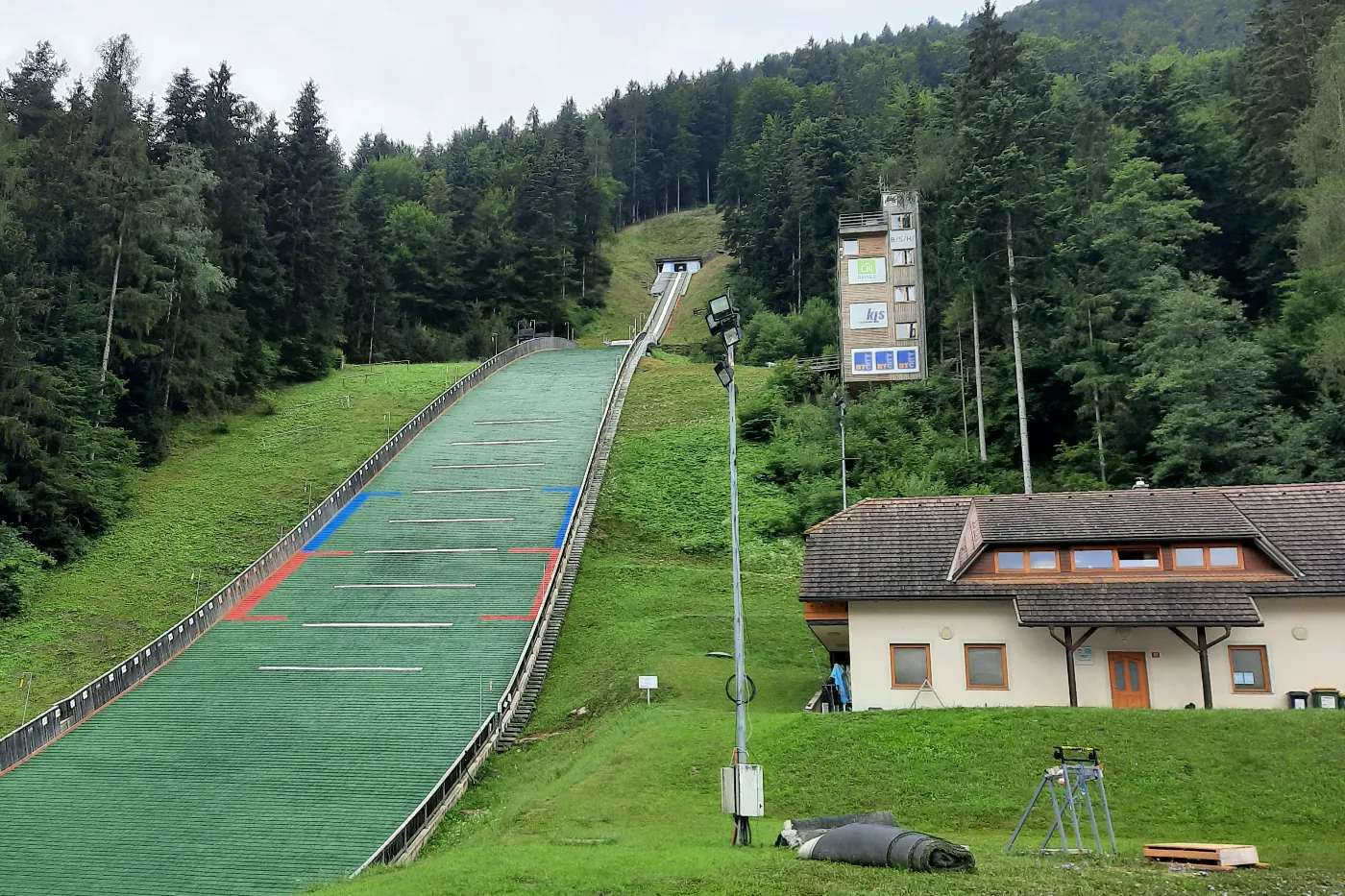
Ljubno ob Savinji is known for ski jumping, but I also like it as a cycling stop. Upper Savinja is full of short routes and viewpoints that are still not overly crowded.
Prebold (and the wider Lower Savinja area) is a good reminder that Savinjska is not only an Alpine postcard. This is where the rhythms shift: plains, hop fields, and quiet rivers. The area is popular with tourists from the land of tulips. Prebold works well as a base for Celje, Laško, or the higher valleys.
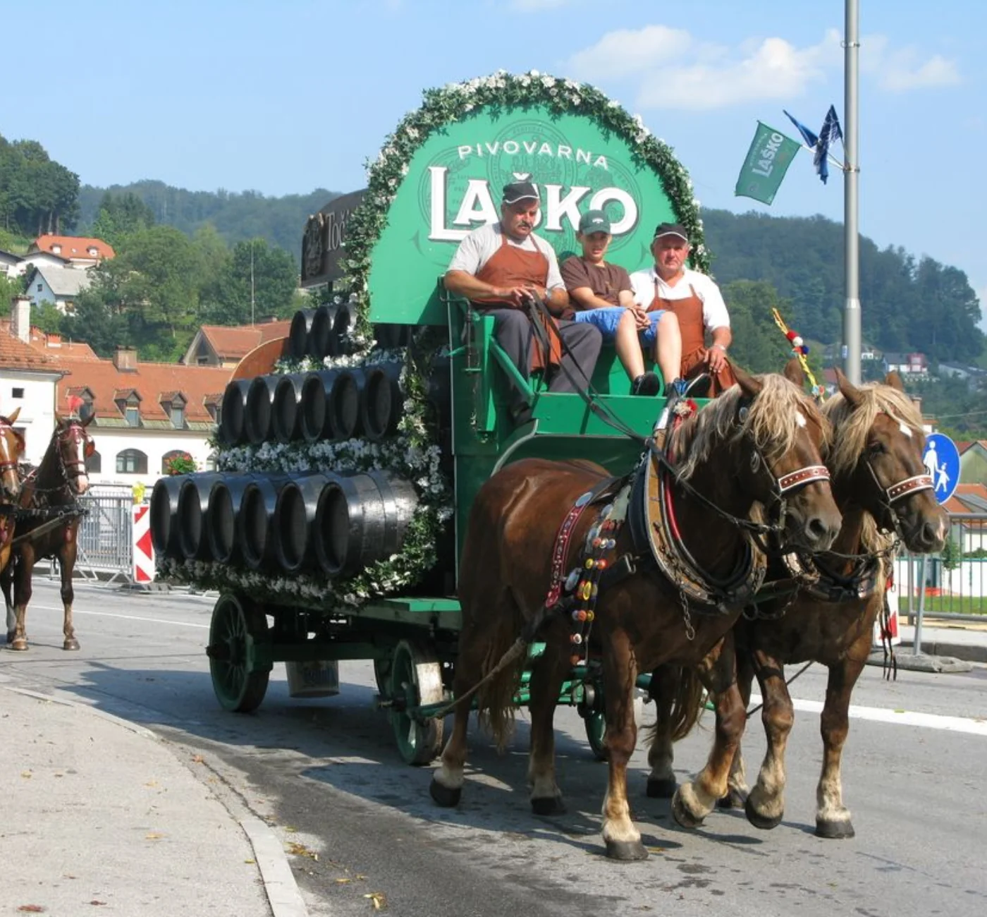
Beer and Flowers (Laško) is one of those festivals that completely reshapes a town for a few days. If you enjoy artists from Slovenia and the wider former Yugoslav space, this is a very different side of Savinjska — louder, more social, and more festival-driven.
Celje Castle is the region’s most classic historic stop. It works best as a viewpoint above the city, while also giving you a quick sense of how important Celje once was in the wider region.
Logar Valley is officially a landscape park and part of an ecologically important area (including Natura 2000), with distinctive natural features that give the valley its Alpine character. An ideal starting point is by Dom planincev.
Region
Central Sava – a mini regional guide
Mining country suspended between its industrial past and a surprisingly quiet present.
Central Sava in Numbers
- Location
- central Slovenia
- Area
- 485 km²
- Population
- 57,195
- Share of Slovenia’s territory
- 2.4%
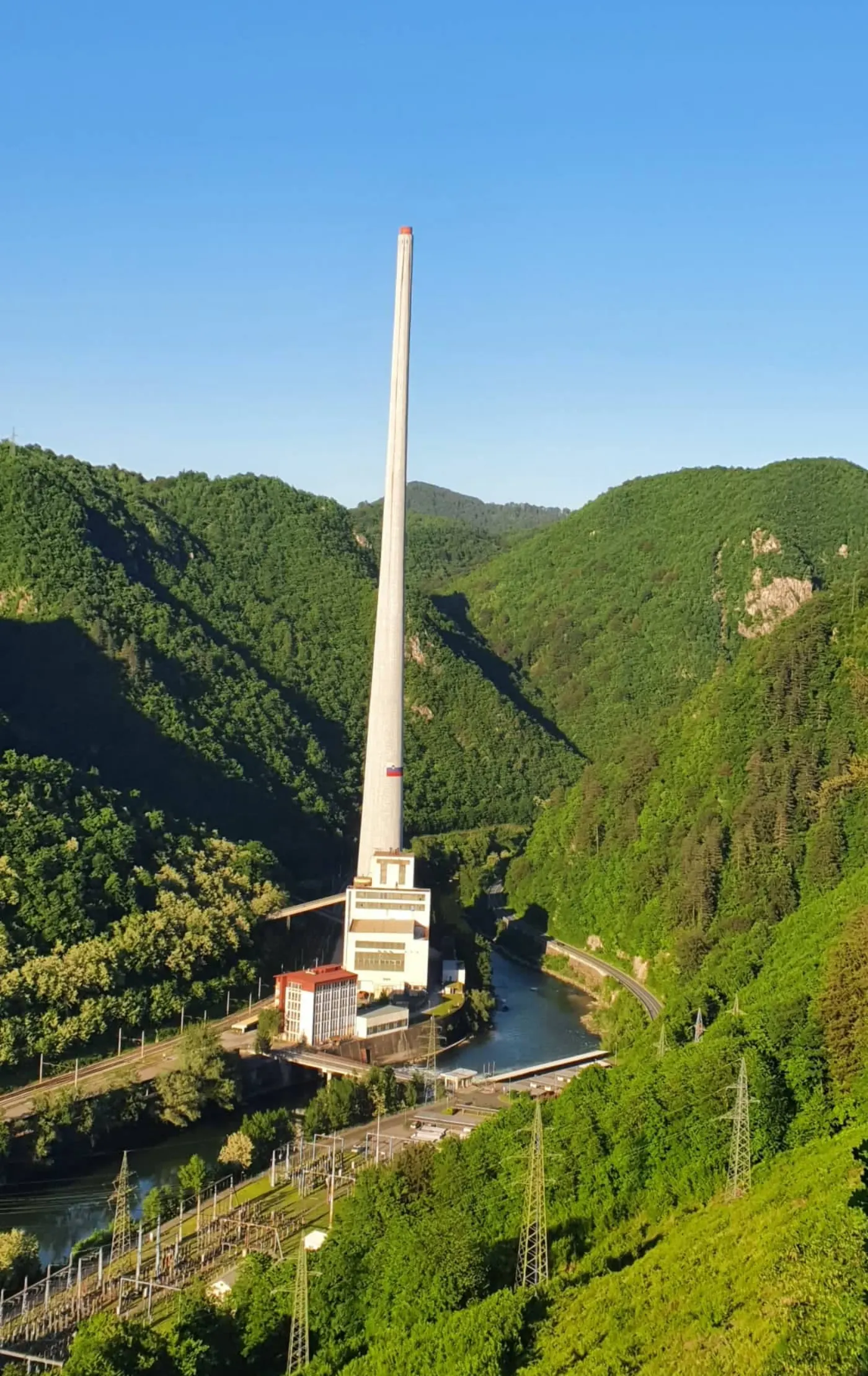
For decades, Central Sava lived in the image of a black, dusty mining region where people worked, not rested. That image stayed in the collective memory, even though the reality has changed quite a bit.
You still notice it in practice. In the middle of summer, when other Slovenian regions are full of tourists, it is not always easy to find open accommodations in Central Sava — not because they are booked out, but because there simply are not that many tourists. The region still runs more on the rhythm of locals than visitors.
And that is exactly where its charm lies. With the closure of the mines and the shutdown of the famous thermal power plant chimney, one era came to an end. Today these places are no longer just symbols of coal, but spaces where a new story is slowly taking shape: more green, a technological revival, and more room for a different kind of trip — quieter, less crowded, more curious.
Zasavje is not a classic tourist postcard. It is a region for the curious — for people interested in the story of a place and its people. It works for a short escape, a day trip, or a stop along the way.
Quick insite
- Kum: the highest summit in the region and its most classic scenic goal.
- Mining heritage: Trbovlje, Hrastnik, and Zagorje reveal stories of coal and the people around it.
- Cycling: surprisingly little traffic, which makes it feel safer.
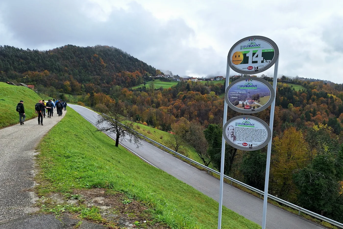
- Levstik Trail: a route following the literary travel piece “Journey from Litija to Čatež.”
Levstik Trail: follows the literary text “Journey from Litija to Čatež” and brings together sport, culture, ethnology, and nature. The starting point is on Levstik Street in Litija’s old town, and the route is marked with information boards where you can read the full original Levstik travel account. Through rolling hills, meadows, vineyards, and forests, you can choose either the northern or southern route (around 21–22 km), taking you past traditional vineyard cottages, old granaries, and the birthplaces of local stories.
And if Levstik Trail inspires you to expand your walking experience into a multi-day journey with more depth, take a look at Camino experiences as well — a travel memoir and lived experience that connects physical walking with reflection and inner transformation through stories from the road.
Region
Lower Sava – a mini regional guide
A region where life slows down. And you slow down with it. Especially if you arrive by bike.
Lower Sava in Numbers
- Location
- eastern Slovenia
- Area
- 968 km²
- Population
- 75,924
- Share of Slovenia’s territory
- 4.8%
We experienced Posavje as part of a cycling trip with friends.
Cycling loop
- Day 1 Kamnik → Radeče
- Day 2 Radeče → Kljunove toplice (Dolenjska)
- Day 3 Kljunove toplice → Dolenjske Toplice
- Day 4 Dolenjske Toplice → Grosuplje
- Day 5 Grosuplje → Kranj
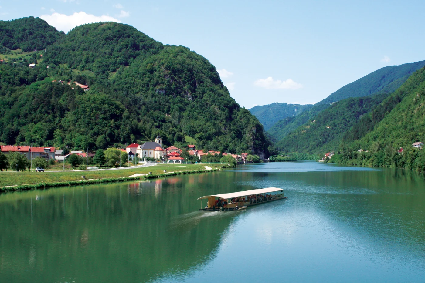
Brestanica
Right along the road from Krško toward Celje lies Brestanica — formerly Rajhenburg. Places along old routes tend to carry a little history and a little transit energy. We passed through by bike, but the feeling stayed with us that a few restful days here would do anyone good.
Radeče
Radeče was our stop on day one, after riding out from Kamnik. We were surprised by the low prices, the slow rhythm, the quiet, and the nature, which still feels like one of the best approximations of something untouched. The river here is full of life and full of fish. We stayed overnight with a local fishing family in Radeče: homey, simple, and sincere.
Kostanjevica na Krki
Kostanjevica na Krki is a special place. This small, picturesque town has something almost island-like about it — as if you are somewhere else for a moment, even though you are still at home. An ideal stop when you want peace and a view that stays with you.
Highlights from the route
Three stops on a cycling trip through the region.
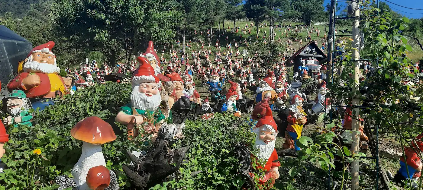
Land of Dwarfs
How to reach the starting point (Radeče – center, ~210 m above sea level).
On foot
- Distance
- ~3.5–4 km (one way)
- Walking time
- 1 hr – 1 hr 15 min
- Elevation gain
- ~200 m
The route leads through central Radeče toward the hamlet of Njivice, then uphill on a forest road to the estate.
By mountain bike
- Distance
- ~4 km
- Ride time
- 15–20 minutes
The route is paved, easy, and runs through the forest to the Land of Dwarfs.
By car
- Distance
- ~4 km
- Drive time
- 7–10 minutes
The road goes through Njivice with a turnoff toward Jelovo. Parking is available by the estate.
Region
Southeast Slovenia – a mini regional guide
Kočevsko and Bela krajina are forests, the Kolpa River, and a rhythm you do not set — you simply fall into it.
Southeast Slovenia by the numbers
- Location
- southern and southeastern Slovenia
- Area
- ~ 2,675 km²
- Population
- ~ 147,000
- Share of Slovenia’s territory
- ~13 %
This region hides quite a lot. Kočevsko wraps you in dense stretches of forest, while Bela krajina opens you up to water, light, and a sense of summer that does not hold back.
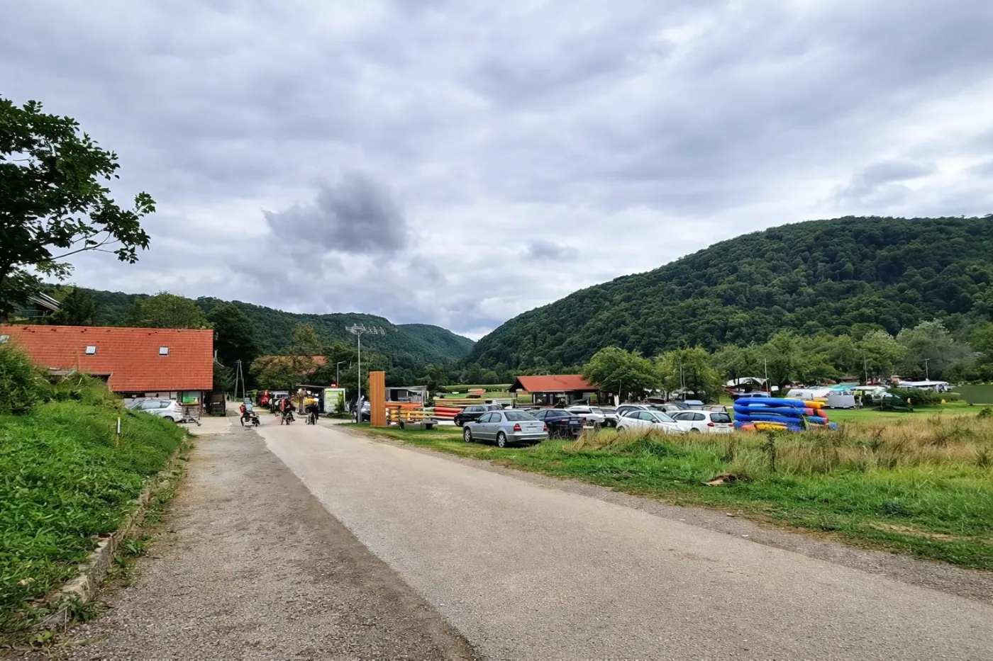
3-day tour: Kočevje → Osilnica → Kolpa → Črnomelj
-
Day 1
Kočevje → Osilnica
-
Day 2
Osilnica → Radenci canoe camp -
Day 3
Radenci canoe camp → along the Kolpa → Črnomelj
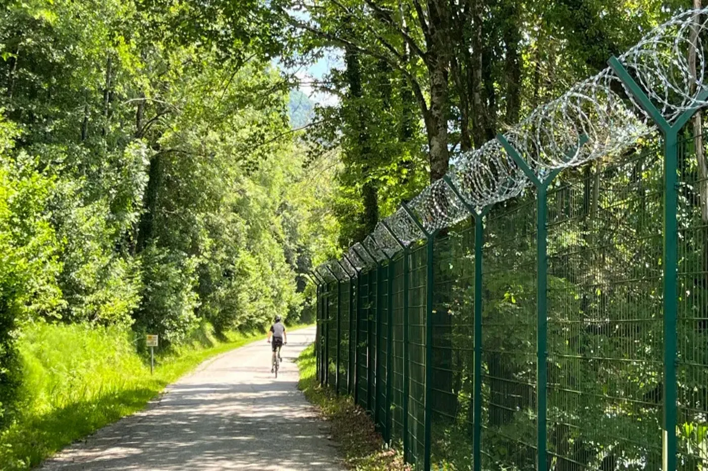
The first day was the most demanding, with respectable climbs and the feeling that you were peeling away layers, one by one. On days two and three, the route drops from the forested Kočevsko area toward the Kolpa, where it follows one of Slovenia’s cleanest and warmest rivers for two days. In Bela krajina, cycling becomes more relaxed: along the river and through an open cultural landscape, you are accompanied by villages, swimming spots, and well-kept cycling routes, including the stretch between Metlika and Stari trg.
For most of the route, we were accompanied by the border fence, put up largely because of migrants. In people’s minds it represents safety; on the ground it mostly creates the feeling that nature has been cut apart and people have been isolated. The Kolpa here is continuous and soft, while the fence is a hard dividing line between neighboring countries.
Kočevje
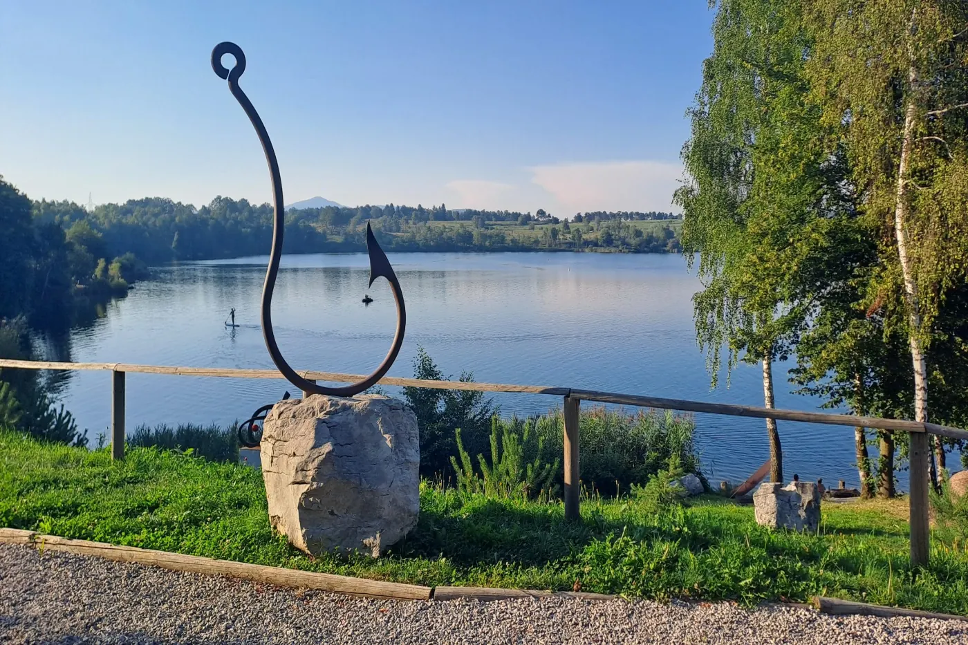
Kočevje is a good start to the stage, with a little city rhythm and a little momentum before the climb to Strma Reber. The surroundings are defined by endless spruce forests. A bear bell is not a bad idea either, since bears enjoy surprises even less than we do. If you have time for a short detour, Kočevsko/Rudniško Lake is the kind of place where the walk just happens on its own. There is a maintained walking and running path around it, and in summer it is a popular swimming spot.
Črnomelj
Črnomelj makes for a different kind of stage ending. Less forest and more “civilization.” The old town is small, but just large enough that practically everything is within reach. The narrow streets and characteristic architecture add to the sense of warmth and familiarity.
If this is your first time in Bela krajina, Črnomelj is a good base: one day for the Kolpa and one day for the Lahinja.
Layers of history: including the Vranov Flight
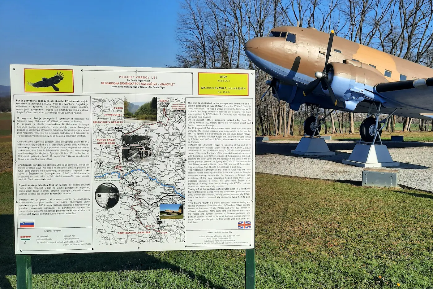
Southeast Slovenia is a place where the lines of history ran far more dramatically than today’s cycling routes. During World War II, Bela krajina was an important area for the partisan movement. Allied missions operated here, air links with liberated territory were maintained, and the landscape repeatedly became an improvised airfield.
One of the better-known events is the so-called Vranov Flight. In August 1944, a Dakota (C-47) Allied transport plane took off from the partisan airfield near Otok by Metlika carrying liberated prisoners of war and wounded people. The flight was part of a broader operation to evacuate Allied airmen and other prisoners from Slovenia to southern Italy. Today, the event is marked by an aircraft monument along the road between Metlika and Vinica.
Region
Central Slovenia – a mini regional guide
Ljubljana is the center. But the region’s biggest advantage is that “switching off” is often just 30–60 minutes away.
Central Slovenia by the numbers
- Location
- central Slovenia
- Area
- ~ 2,334 km²
- Population
- ~ 560,000
- Share of Slovenia’s territory
- 11.5 %
Ljubljana
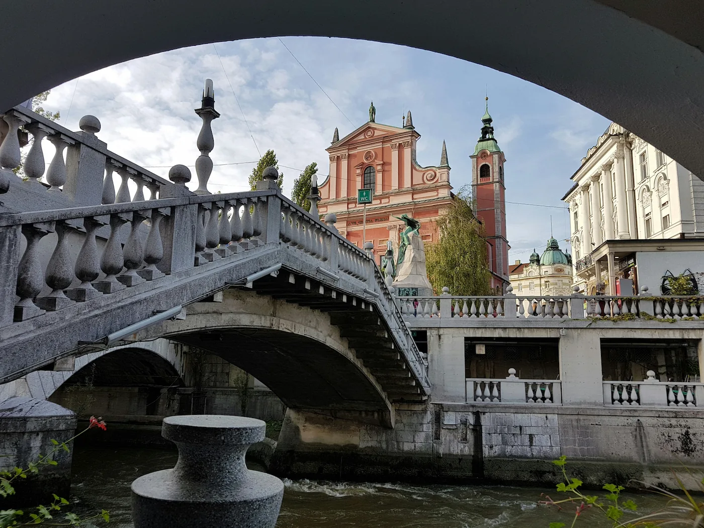
In Ljubljana, you find yourself between two worlds: between city bustle and forest silence, between a glass of wine by the Ljubljanica and a sunset on Šmarna gora. It is a city where you get both.
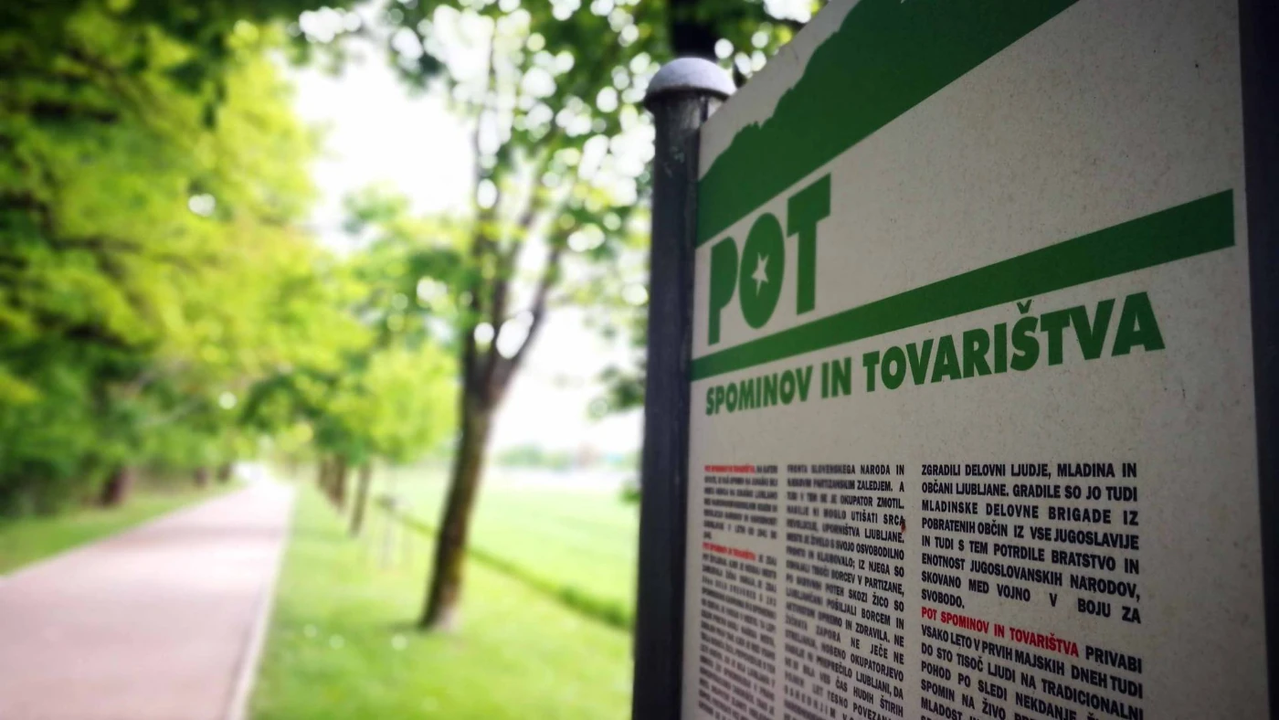
PST: Path of Remembrance and Comradeship
PST is Ljubljana’s circular route that takes you away from traffic lights while still keeping you “in the city.” In practice, it is a fairly substantial walk with a bit of forest, some meadows, and nearby neighborhoods. If your approach to exercise is moderate, PST is excellent for running, walking, or cycling.
- How to experience it: split it into 2–3 “stages,” each ending somewhere that earns you a proper break.
- When: early in the morning or late in the afternoon.
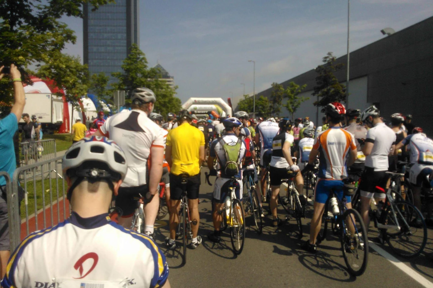
Marathon Franja
The cycling celebration that is Marathon Franja is one of those days when the sound of chains replaces part of Ljubljana. At the start, there is usually a mix of nerves, adrenaline, and a lot of energy.
- Start and finish: Ljubljana.
- The feeling: from city buzz to empty country roads.
- Best moment: the instant you safely cross the finish line of the 96 km or 156 km challenge.
Ljubljana
Iški Vintgar
When you need water, shade, and the feeling of still being close to the city.
Iški Vintgar is a narrow gorge carved by the Iška River through limestone bedrock. It lies on the edge of the Ljubljana Marshes, beneath the forested slopes of Mokrec, and is considered one of the easiest natural escapes to reach from the capital. The path along the water feels wild enough to stay authentic, yet maintained enough that it does not require special fitness. Wooden footbridges, rocky sections, and roots underfoot give the route its character. Here, the Iška creates narrow corridors, small waterfalls, and distinctive pools.
Kamnik
Kamnik has a long tradition and the reputation of being a town that gets you into the hills faster.

Volčji Potok Arboretum
If you are looking for a place where the day starts by the Kamniška Bistrica River and continues into the hills, Kamnik is an excellent choice. It does not yet play an oversized tourist role, but it is still a magnet for a getaway or a longer stay.
Kamnik is a rewarding base for short green escapes, including trips to Volčji Potok Arboretum. The park covers 85 hectares, includes nearly 5,000 plant species, and even a few prehistoric animals. Because of that, a visit quickly becomes more than just a short detour.
Hill escapes
Kamniška Bistrica, Velika planina, and the Kamnik-Savinja Alps: a triangle that forms the backbone of the region.
This is a true weekend-escape region. Kamniška Bistrica is a base with a rich history, Velika planina is scenic therapy, and the Kamnik-Savinja Alps are among the most striking mountains in this part of Slovenia.
- Kamniška Bistrica: a valley also known for Tito’s lodge.
- Velika planina: huts, alpine pastures, and spring crocuses.
- Kamnik-Savinja Alps: when you want an active day and some altitude.
Hill highlights
Kamniška Bistrica / Velika planina / Kamnik-Savinja Alps


Region
Upper Carniola – a mini regional guide
The Julian Alps, mountain passes, and valleys are a classic that never disappoints.
Upper Carniola by the numbers
- Area
- 2,137 km²
- Population
- ~ 212,000
- Share of Slovenia’s territory
- ~ 10.5 %
- Location
- northwestern Slovenia
Gorenjska is postcard Slovenia.
It is the version we show to visitors — and the one we keep returning to ourselves. You do not have to climb Triglav. There is plenty more here.
Cycling stage
The first day of the Kranj – Ručinj tour began right here. From Kranj westward, through typical Gorenjska scenery: flatland, forest, village, deep gorges, and steep rock faces.
- Day 1: Kranj → Ručinj (before Nova Gorica)
- Day 2: Ručinj → Kanal ob Soči
- Day 3: Kanal ob Soči → Camp Sestiana (ITA)
- Day 4: Sestiana → Izola (annual VW Beetle gathering)
Cycling through the Radovna Valley
If you are looking for a quiet cycling classic without too much traffic, the Radovna Valley is almost meditative. A mix of gravel and asphalt leads you through a narrow Alpine valley along the Radovna River, tucked between the slopes of the Mežakla and Pokljuka plateaus. Along the way, you can also discover cultural details such as Pocar Farmstead or the old sawmill and mill beside the route.
Kranjska Gora Trail
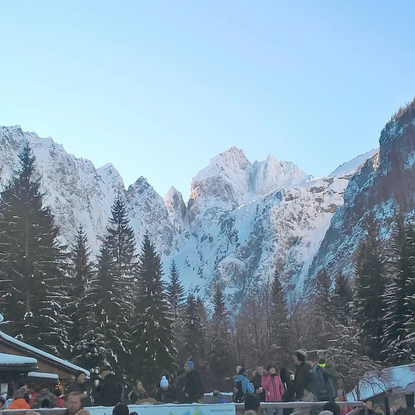
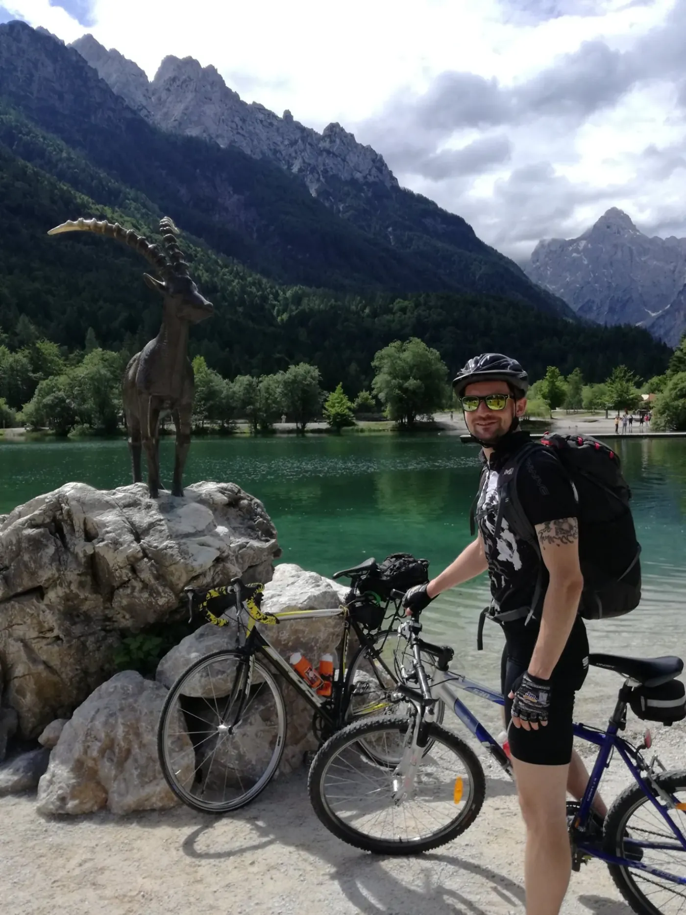
Kranjska Gora Trail (held in September) blends nature and movement: the trails wind through forests, past Lake Jasna, and onward toward ridgelines with views of the Julian Alps (the Špik group) and Vitranc.
The Road to Brezje (“Camino” Brezje)
The road to Brezje is one of those walks where it does not really matter whether you are a pilgrim or simply a hiker.
The Basilica of Mary Help of Christians in Brezje is Slovenia’s largest pilgrimage site. But the journey there is what makes the story. What matters is the moderate pace, the smaller climbs, and the feel of the road — not just the destination.
The Camino to Brezje is a small reminder of how powerful the experience of the journey itself can be. That same feeling once took me much farther. I wrote the whole experience — from the first day to the final step — into a book.
Kranjska Gora and Planica
Vitranc is the classic slope where Alpine skiing history gets written. The course has been part of the World Cup since the 1960s, when the Vitranc Cup became a fixture on the international competition calendar. You can expect prices of around €49 for adults, €44 for youth, and €30 for children (day pass).
Ski jumps are not just structures, but symbols of Slovenian sporting identity. In Planica stands one of the world’s largest ski flying hills — the Gorišek Brothers Flying Hill — where world records in ski flying have fallen and continue to fall. Zipline Planica lets you descend by cable from the top of the jump, offering a safe but adrenaline-filled approximation of what ski jumpers feel during flight.
The Julian Alps
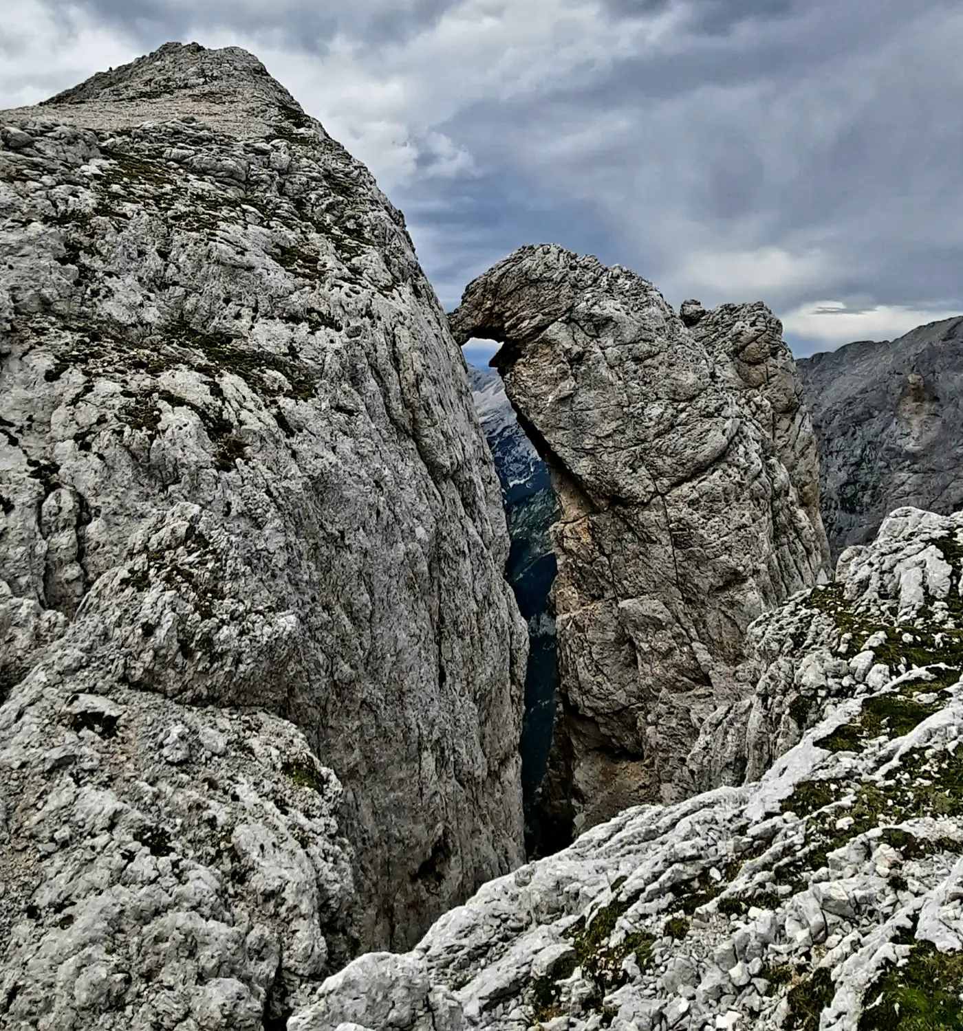
Gorenjska is home to the Julian Alps. A substantial part of the Slovenian Mountain Trail runs precisely across the huts and summits of the Julian Alps. I have already walked quite a few of them, yet there is always another new challenge, another scenic peak, and another hut with excellent homemade food.


Region
Littoral–Inner Carniola – a mini regional guide
Karst, disappearing landscapes, and vast forests. You can truly see a lot here.
Primorsko-Notranjska is a region of contrasts: on the surface, pines, Karst edges, and vast forests; beneath your feet, one of the best-known cave systems in Europe. You get the feeling that you have been in two different worlds in a single day — and that “another dimension” is actually a pretty accurate description.
Littoral–Inner Carniola by the numbers
- Location
- southwestern Slovenia
- Area
- 1,456 km²
- Population
- ~ 54,000
- Share of Slovenia’s territory
- ~ 7.2 %
Why the region stands out
-
Park of Military History (Pivka):
a museum-experience center that gives a very concrete sense of what history here once looked like, and what the present looks like now.
-
Postojna Cave:
one of the world-recognized wonders. You will not avoid the crowds entirely, but you will see vast underground chambers and the olm — the symbol of Slovenian Karst. It is one of those experiences that stays with you long after you come back into daylight. In the cave, bring at least a light jacket or long sleeves. -
A disappearing world:
Cerknica and the intermittent lakes of Pivka are like a textbook in nature, only more real. -
Slivnica:
for when you need silence and the feeling of being far away — even when you are not.

Slivnica (1,114 m)
A scenic, technically easy hike above Lake Cerknica. Slivnica is known as the “witch mountain,” but today above all as a short escape into quiet with lovely views toward Inner Carniola.
- Starting point: Dolenje Jezero (Lake Cerknica).
- Destination: Slivnica (1,114 m).
- Hiking time: 1 hr 15 min.
- Elevation gain: approximately 400 m.
- At the top: Dom na Slivnici and a viewpoint just below the summit.

Nanos (Pleša, 1,262 m)
A Karst plateau above the Vipava Valley with one of the finest views in western Slovenia. Because of its open grassy slopes and the bora wind, Nanos feels distinctive in every season.
- Starting point: Razdrto.
- Destination: Pleša (1,262 m).
- Hiking time: 2 hr 30 min.
- Elevation gain: approximately 800 m.
- Continue on: optional loop via Vojkova koča.
Cycling: from Kamnik to the sea
Quite a few years ago, a friend and I did one of the lovelier cycling tours from Kamnik to the sea. Primorsko-Notranjska was a key transition landscape along the way. This road also carries a memory of nostalgic times, when people drove to the sea by the old road — today a true mecca for motorcyclists and cyclists. You will meet a few challenges on the way, especially the Vrhnik climb, but otherwise the route flows nicely, stays varied, and is just long enough to make the sea feel fully earned at the end.
Pivka Cave and Black Cave
If you are looking for a trip idea in the Inner Carniola region, Pivka Cave and Black Cave are excellent picks. Both are part of the broader Postojna Cave system, one of the most recognizable Karst phenomena in Slovenia. They offer, however, a somewhat different and more intimate underground experience. The route through an artificially excavated tunnel continues into Black Cave, which, with its darker and less altered appearance, reveals a different face of the Karst underground. Like most cave sections in the Postojna system, the temperature is around 10 degrees Celsius. A guided tour is possible, takes about 90 minutes, and lightens your wallet by around €20.
Quick guide
- For 1 day: Park of Military History or a cave, plus a short walk by the lake.
- For 2–3 days: cave, intermittent lake, and a climb up Slivnica.
- Best time: spring–fall, or summer, when the cave works as an excellent “cooler.”

Postojna Cave
If there is one place that put the region on the global map, it is Postojna Cave.
approx.: €32.90
The train ride into the cave, the huge chambers, the stalactites you know from textbooks, and that feeling that you are part of something older than anything you are used to on the surface. If you come outside peak season or early in the morning, the experience feels much more intimate.

Predjama Castle
Ten minutes away stands one of the most photogenic places in Slovenia. Predjama Castle is not just a castle — it is a castle built into a cliff face.
approx.: €21.00
The story of Erazem of Predjama adds another layer of romance and defiance. If you combine the cave and the castle in a single day, you get the perfect “Karst-and-history package.”
package (cave and castle): €46.50

Park of Military History
In Pivka, you will find something you might not expect in the middle of Karst forests: tanks, a submarine, military aircraft.
approx.: €10.00
The Park of Military History is not just a collection of exhibits, but a very concrete insight into the military and political history of the region.
with submarine tour: €14.00
Region
Gorizia – a mini regional guide
Goriška brings together three distinct landscape identities: the Alpine Soča Valley, the vineyard hills of Brda, and the Karst transitions toward the sea. Because of this geographic diversity, the region lets you move quickly from a mountain setting into a milder, Mediterranean climate.
The region by the numbers
- Location
- western Slovenia
- Area
- ~ 2,325 km²
- Population
- ~ 118,000
- Share of Slovenia’s territory
- 11.5 %
Cycling sections
It runs along a well-maintained paved path, mostly separated from traffic, so it is suitable for families as well. The route from Nova Gorica to Solkan is about 5 km long (one way) and almost flat, making it ideal for an easy outing or a warm-up before a longer ride. The Soča River stays with you the whole time, along with plenty of benches and attractive lookout points. You can extend the route with a climb toward Kekec (Sveta Gora / above Nova Gorica). The ascent is solid and long enough to reward you with a beautiful view over the Soča Valley, the Goriška plain, and Brda. The special reward after the climb is baked crêpes, which are almost a mandatory choice. Another excellent option is the Žogica spot in Solkan. Its atmosphere blends old-fashioned furniture with the kind of hominess that makes you want to stop and treat yourself to the daily lunch menu.
-
Day 2
Ručinj → Kanal ob Soči -
Day 3
Kanal ob Soči → Tolmin -
Day 4
Tolmin → Kobarid / Bovec
The Julian Alps
In the Goriška region, the Julian Alps show a more rugged edge. This is not the part of the range defined by high mountain passes and postcard views of Triglav in the foreground, but by steep limestone walls above the Soča Valley, narrow gorges, and forested slopes above Solkan, Plave, and Kanal. The mountains only begin to rise in earnest as you head toward Bovec and Trenta.
- The Soča Valley: the natural spine of the region — for riverside walks, SUP, or rafting.
- Trenta / Lepena / Koritnica: three remote, glacier-carved valleys in the heart of the Julian Alps.
- Viewpoint icons: the two “kings” of the mountains here are Jalovec and Bavški Grintavec.
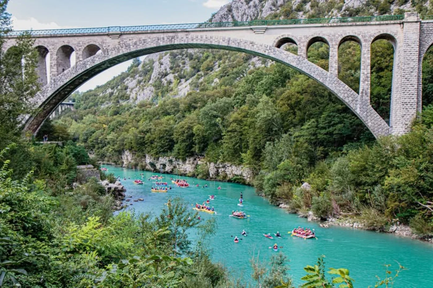
Juliana Trail
Juliana is a 270 km circular hiking trail, divided into 16 stages, that leads you around the Julian Alps. In the Goriška section, it winds through the Soča Valley and through scenic places such as Most na Soči, Tolmin, Kobarid, and Bovec. It is ideal if you want to discover the region’s rich natural and cultural diversity while staying in motion.
- Top experience: a slow discovery of the region.
- Extra: 1 day for activities on the Soča (rafting, bungee).
The Soča Front
Between 1915 and 1917, the Soča Valley was part of one of the most brutal mountain fronts of the First World War.
Even today, traces of trenches, caverns, and military paths remain in the hills, and pieces of equipment and unexploded ordnance are still occasionally found in the ground. One of the peaks was named Prestreljenik.
The landscape is beautiful — but it carries the weight of memory.
- Interesting note: the breakthrough at Kobarid reshaped the course of the war.
- Personal note: the song Ghosts in the River grew directly out of these stories.
Kobarid Museum
If you want to understand what happened here, Kobarid Museum is the best point of entry. It is not just about artifacts, but about human stories — soldiers, locals, mountains, and the river that witnessed it all up close.We also collaborated with the museum while filming a music video, so this part of the region will always resonate with me in a special way.
- Time needed: 60–90 minutes plus a walk along the Walk of Peace.
- Tip: for some people, the material can be quite vivid.
Tolmin: music and nature
Tolmin blends summer festivals, gatherings at the confluence, and a sense of remoteness once you descend into the gorges.

Festivals in Tolmin
Festivals by the Soča are a phenomenon of their own: camping, the river, and mountains in the background. All of it happening in an area once marked by the darker sides of history. Today, life, togetherness, freedom, and connection among people from all over the world are celebrated here. The festivals run through practically the whole summer.
- The feeling: summer, the Soča, and music.
- Tip: stay at least three days for the full experience.

Tolmin Gorges
The Tolmin Gorges reveal a more dramatic side of the valley: a gorge where the Tolminka and Zadlaščica rivers carved narrow canyons filled with shade and cool air.
approx.: €8–12
- Best time: morning or late afternoon.
- Tip: you can look for parking in town and walk over.
Goriška Brda
Brda means hills, vineyards, views, and that feeling that there is nowhere you need to rush to. Ideal for a food-focused day, a visit to a vineyard cottage, and buying top-quality wine at consistently fair prices.
- Rhythm: slow. Brda is ideal for food and wine outings.
- Cuisine: locally produced.
- Viewpoint moment: sunset on one of the hills is more than enough of a plan.
Region
Coastal-Karst – a mini regional guide
The sea and the Karst are always a winning combination. Morning by the coast, a day among stone Karst villages, a view from Socerb or Slavnik, and an evening with wine in Marezige.
The region by the numbers
- Location
- southwestern Slovenia
- Area
- ~ 1,044 km²
- Population
- ~ 116,000
- Share of Slovenia’s territory
- ~ 5.1 %
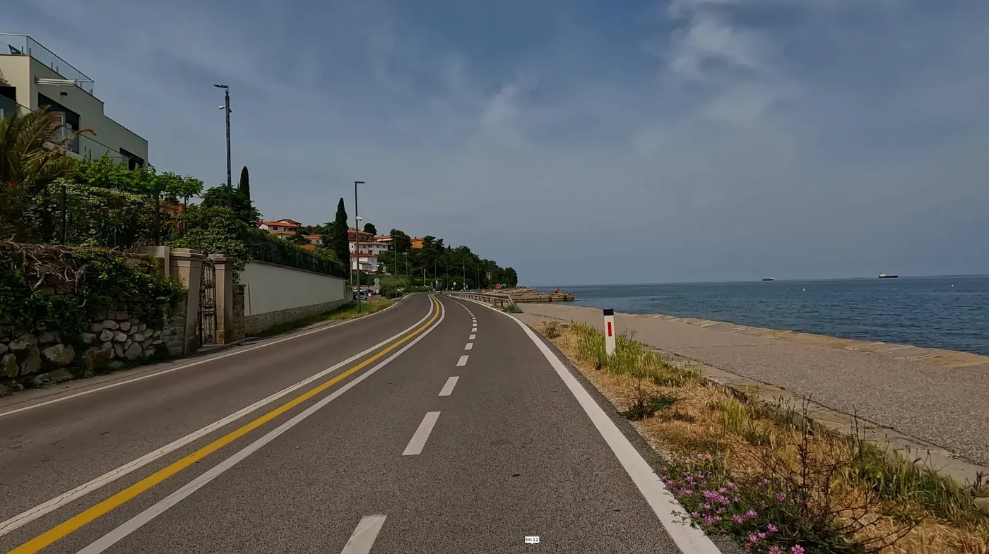
The sea
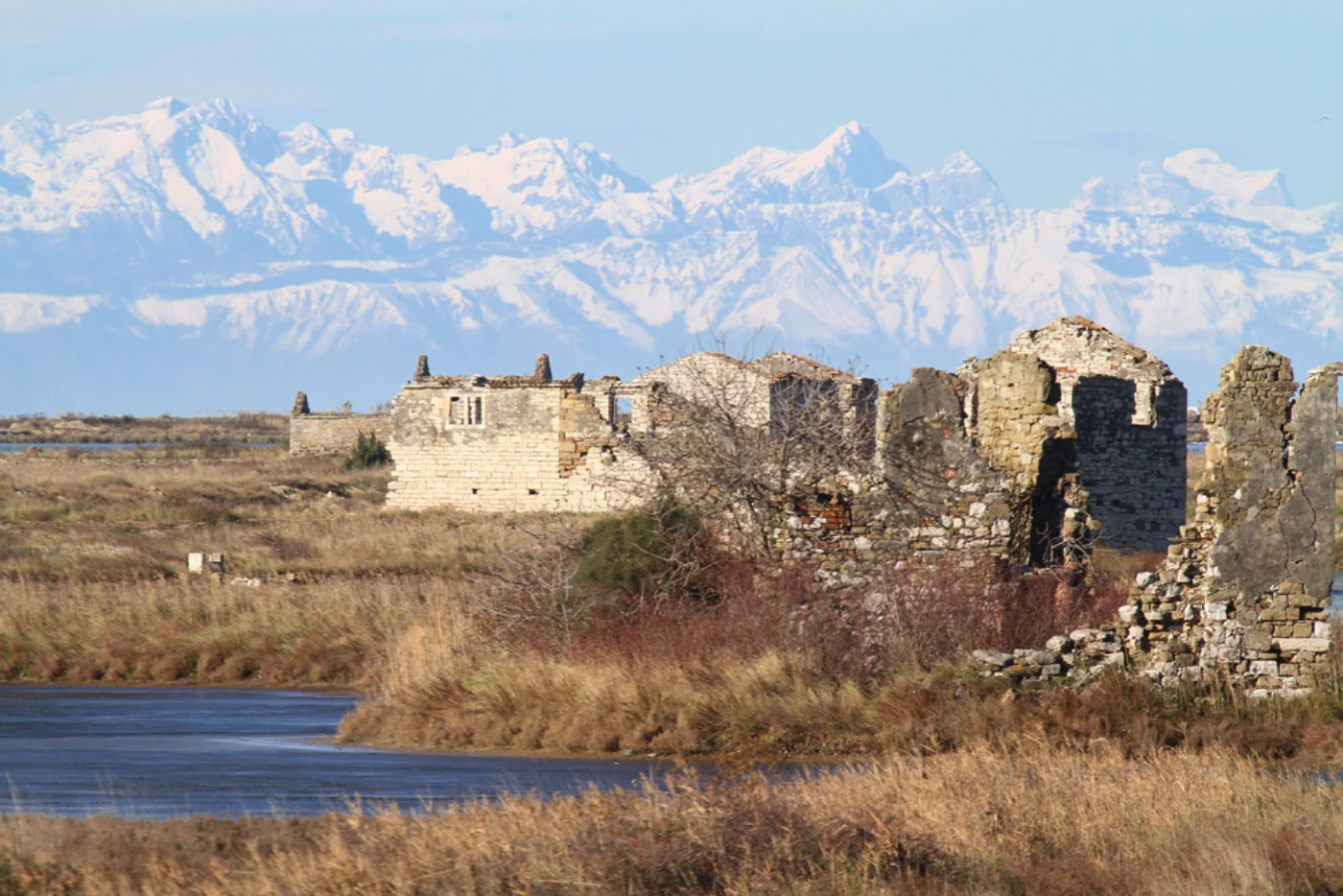
Swimming is possible in Portorož, Piran (Fiesa), Strunjan, Izola, Koper, and Ankaran, where there are maintained beaches and easy sea access. In summer, the sea usually warms up to around 23–27 °C (depending on the weather and time of year). If you prefer a more laid-back version of the coast, there are nearby campgrounds as well — for example Kamp Lucija (Portorož), Camping Adria (Ankaran), or Kamp Belvedere (Izola).
Piran
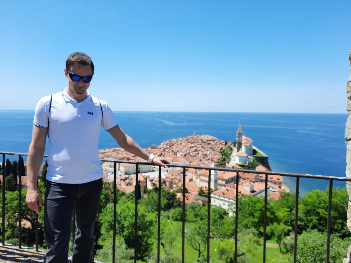
Piran is a historic town with a distinctly Mediterranean character. The center of it all is Tartini Square, where you get the feeling that music is echoing in your head even though no one is playing. From there, you can walk through the narrow streets all the way to the defensive walls and the Church of St. George on the hill above town, where the view is at its best. The old town is closed to traffic, so exploration happens on foot — through narrow alleys, past the walls, and out to the lighthouse at Cape Madona.
And when hunger hits, Piran will not let you down. Hidden among the stone streets are simple little places for ćevapi and wine stories over a glass of Refošk. Or you can go for dinner with a sea view and an even more authentic Piran evening.
Hill country: Socerb and Slavnik
Two options for when you want to see the coast differently — from a lookout above the sea, where the horizon opens and the bay comes into view.
Socerb
Socerb Castle stands on the Karst edge high above the coast and offers one of the finest views over Slovenia’s littoral. From the stone walls, the view stretches across the Bay of Koper, toward Trieste, and far out over the Adriatic.
Slavnik (1,028 m) – the classic trail from Podgorje
Slavnik is one of the most popular peaks in the Slovenian Littoral. The classic route starts in the village of Podgorje: ~1 hr 40 min of hiking, ~510 m of ascent, and the trail is marked and not demanding.
- Starting point: Podgorje (parking is available in the village).
- Who it is for: anyone who enjoys a good walk.
Cycling path by the sea
The best-known coastal cycling section follows the line Koper → Izola → Strunjan → Portorož (Lucija)
and connects to the Parenzana route (the former narrow-gauge railway). The Slovenian section is
paved and forms part of marked cycling connections.
- Length: approximately 123 km between Trieste (ITA) and Poreč (CRO).
- Tip: I recommend a stop in Grožnjan (CRO).


Lipica Stud Farm
Lipica, founded in 1580, is the cradle of the Lipizzan horse and one of Europe’s oldest stud farms. The park, centuries-old tree-lined avenues, and white horses give the place a refined, elegant tone.
The guided tour lasts about 60 minutes and, depending on the day’s schedule, includes the key parts of the estate: the Velbanca stable, the Lipikum museum, the carriage exhibition, and an introduction to the Lipizzan horses.

Marezige for food lovers
If you want a proper “Istrian” evening: wine, a view, and something good to go with it. It all works best in the late-afternoon light, when the Bay of Koper turns warmer in color and the whole scene becomes just a little more cinematic.
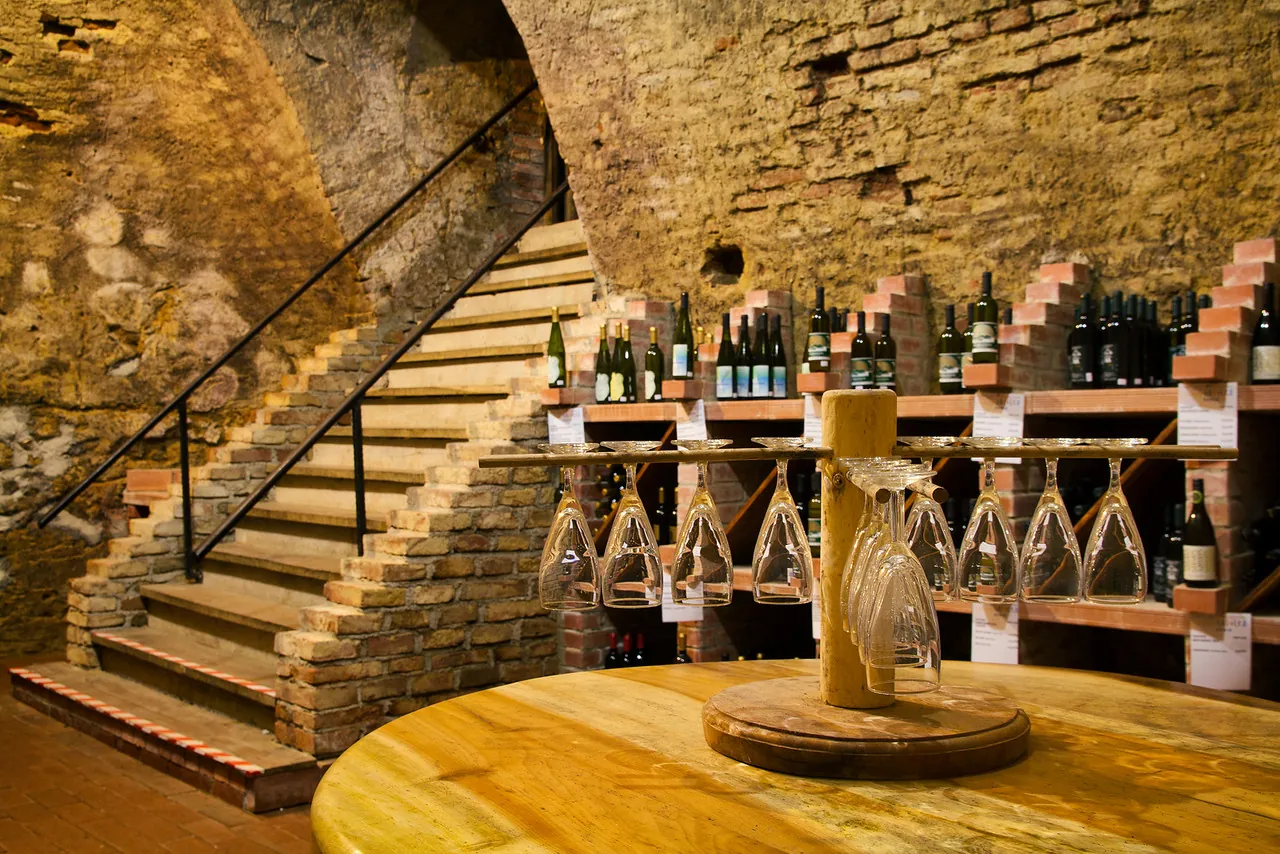
The Wine Fountain is an especially interesting concept — a “glass with a view” experience where you sample local wines, especially Refošk. It is an indigenous red variety that thrives in the distinctive red Istrian soil, terra rossa. When you buy a tasting package, you also receive a glass and tokens for the tastings.
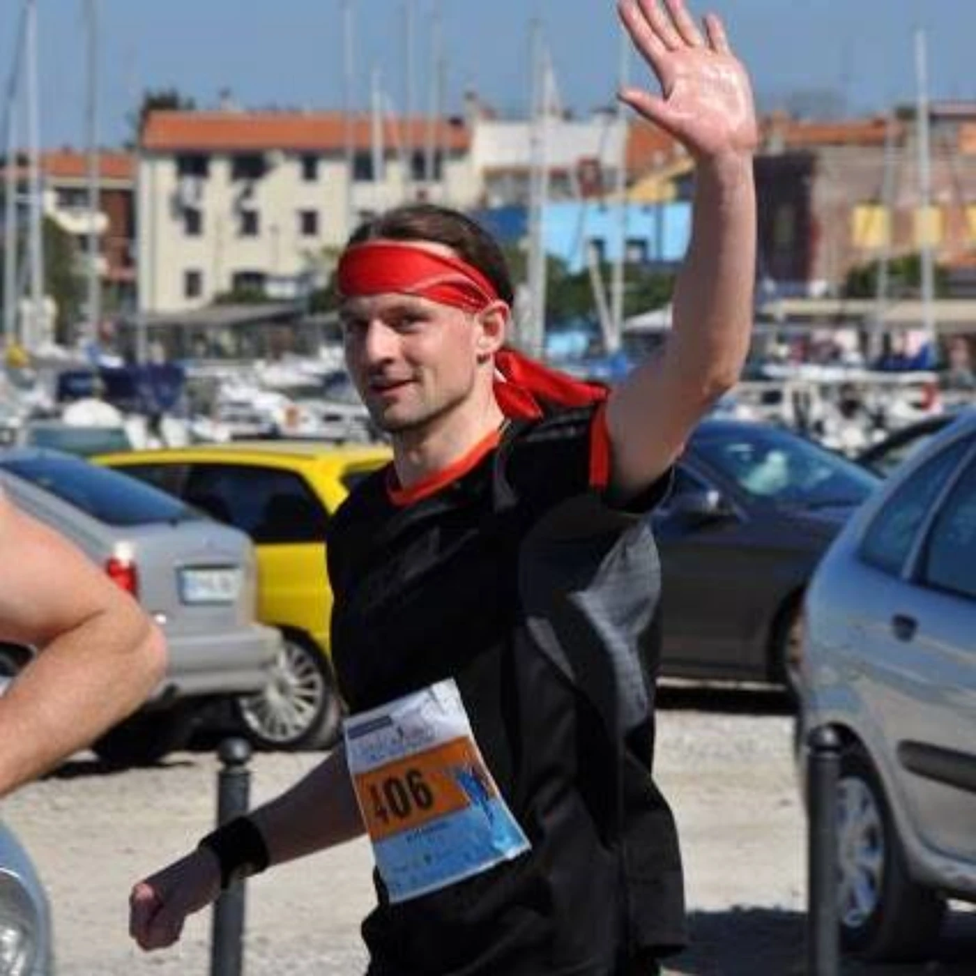
Istrian Marathon
The Istrian Marathon links Koper, Izola, and Piran through a varied coastal route that runs past the salt pans and along the sea. It takes place in April and brings together runners from different countries in Koper.
Short route description
The marathon course is designed as an “Istrian loop” connecting Lucija/Portorož, Strunjan, Izola, Koper, and Ankaran, before returning toward the starting point.
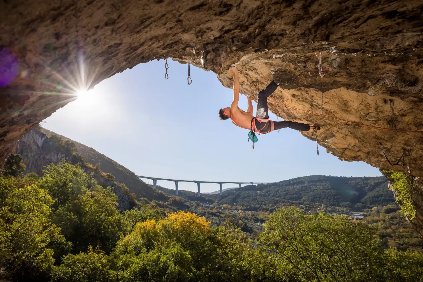
Osp – sport climbing
The Osp wall is one of the most recognizable climbing “amphitheaters” in Slovenia — and part of the history of Slovenian climbing.
According to the Alpine Association of Slovenia, Osp is one of the oldest climbing areas in Slovenia. The wall is strongly overhanging (and in places very high), which makes it especially popular with experienced climbers, while several other excellent walls are nearby as well (for example Mišja peč).
- Best time: spring/fall.
- Tip: check current restrictions and climbing rules before you go.
Highlights from the route
Three stops that sum up the coast and the Karst edge well.
What to See?
If you want to understand Slovenia quickly, look at it through its regions. Each one has its own rhythm and its own kind of appeal.
Eastern Slovenia
Northern and northwestern Slovenia
- Carinthia – a region of forests, ridgelines, underground rivers, and people with a strong sense of community.
- Savinja – one of the most diverse regions: Alpine valleys, vineyards, and ruling dynasties.
- Upper Carniola – the Julian Alps, passes, and postcard valleys: classic Slovenia, and a good reason to return.
Central Slovenia
- Central Slovenia – Ljubljana as a base, plus Iški Vintgar, Velika planina, the Kamnik-Savinja Alps…
- Central Sava – a hilly landscape, meadows, vineyards, and forests, characteristic of the Levstik Trail.
- Lower Sava – life-filled rivers, smaller towns, trails, and surprises by the road.
Western/Southern Slovenia
- Littoral–Inner Carniola – caves, forests, disappearing landscapes, and “another dimension” underground.
- Gorizia – the Alpine Soča Valley, the vineyard hills of Brda, and Karst transitions toward the sea.
- Coastal-Karst – Piran, traditional salt pans, the Karst edge, Socerb/Slavnik, and an evening in Marezige.
- Southeast Slovenia – Kočevsko and Bela krajina with forests, lakes, and the border river Kolpa.
What to Do?
The real question is: what kind of day are you after? Below are four directions, with regions and practical ideas.
A mountain day
- Alpine classic: Upper Carniola with the Julian Alps, passes, and Alpine valleys.
- Panorama and history: Savinja with Logar Valley, the Kamnik-Savinja Alps, and traces of Roman Celeia.
- Hill escapes: Central Slovenia, when you want an active day and some altitude.
- Shorter or longer routes: Central Sava with quick tours or a longer walk along the Levstik Trail from Litija to Čatež.
A cycling day
- Hills and passes: Upper Carniola with many maintained cycling routes and legendary climbs.
- Valleys with a view: Gorizia with the Soča Valley and Savinja from Logar Valley to the Celje Basin.
- Gravel/forest stages: Southeast Slovenia through Kočevsko and Koroška through its wide network of forest roads between Peca, Uršlja gora, and the Meža Valley.
- Hills and rivers: Mura among the vineyards of Goričko and Drava along the Drava River.
- Coastal classic: Coastal-Karst and the classic route known as the Parenzana, running between Trieste (ITA) and Poreč (CRO).
A run / trail day
- Gorenjska: Kranjska Gora Trail.
- Zasavje: the winter Knap Trail.
- The coast: Istrian Marathon.
- Goriška: Soča Outdoor.
An easygoing day
- Wine and hills: Gorizia and Mura.
- The coast: Coastal-Karst through a waterfront walk or a food-focused afternoon in Marezige.
- Summer refreshment: Southeast Slovenia with the Kolpa or Gorizia with the confluence area.
- Underground exploration: Littoral–Inner Carniola with one of the most recognizable Karst phenomena in Slovenia.
If longer walks and pilgrim routes speak to you, I wrote a book about one of them.
Itineraries
Below are tips and ideas for multi-day trips.
3 days
- Ljubljana (city walk and evening atmosphere).
- Upper Carniola (Alpine panorama).
- Coastal-Karst (Piran/the coast for the finish).
7 days
- Central Slovenia (Ljubljana and nearby day trips).
- Upper Carniola (the Julian Alps, valleys, and passes).
- Gorizia (the Soča region and Brda as a contrast).
- Coastal-Karst (the coast and Karst wonders).
2–3 weeks
- Mura and Drava – vineyards and events.
- Carinthia and Savinjska – the varied northern part of the country.
- Central Sava and Lower Sava – quieter regions full of surprises.
- Littoral–Inner Carniola – a diverse and distinctive area.
- Gorizia and Coastal-Karst – colorful and ideal for foodies.
- Southeast Slovenia – a wooded region rich in history.
Practical Info
A few practical tips.
Getting between places or regions
A car or motorcycle gives you the most freedom, especially for smaller towns and trailheads. For the city side of things, the natural base is Ljubljana, and for the coast it is Coastal-Karst. If you are traveling by bike, you can plan your days stage by stage. You will find a few ideas here.
Season
Summer is great for cooling off in the Soča or the Kolpa, while spring/fall is ideal for mountain outings in Upper Carniola or Savinja. Winter is great for an afternoon of skiing in Kranjska Gora or Cerkno, or for sledding on Velika planina.
Safety in the mountains
Slovenia is safe. In the mountains, though, weather and gear are always part of the story. If you are planning a high-mountain outing (Upper Carniola/Savinja/Central Slovenia), read the tips on the pagebefore you head up.
Payment
Euro. Cards work almost everywhere, but in smaller places it is smart to carry some cash too (especially in rural areas and with smaller providers).